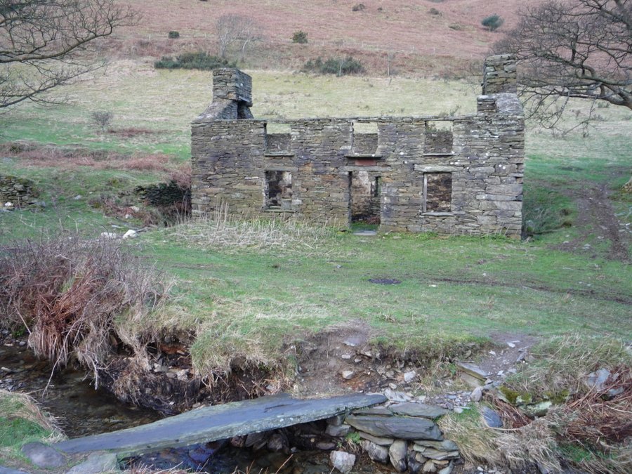
Monday 28 March 2011

Bradda

A three hill walk.

Monday 28th March 2011

We started off from the Sloc – the dip between Cronk ny Arrey Laa and Lhiattee ny Biennee on the south west coast of the Island.

I stopped on the steep climb up Lhiattee ny Biennee to take a photo of the coast – looking north towards Niarbyl (the tail of rocks).


Then I turned slightly inland to photograph the road from the Sloc, climbing up and around Cronk ny Arrey Laa.  This is one of the roads on the Island that occasionally has to be closed when there is a heavy fall of snow.  The slightly flat top of the small hill at the bottom of the slope is said to the site of a Pictish village.


The path at the top of Lhiattee ny Beinnee continues along the long ridge before descending the Carnanes (at the southern end of the ridge) to Fleshwick.

The next photo was taken as we walked down from the Carnanes and shows the view across the valley towards Bradda Hill.  There is still evidence of the great fire of October 2003 which burned for four days.  It destroyed most of the vegetation on the hill and even burned down into the peat.  The areas which escaped the fire can be picked out.  They show up as rusty patches of dead bracken which will turn green in a few weeks as the new fronds emerge and unfurl.


This is Fleshwick Bay – where we saw our first basking sharks many years ago.


We didn't 
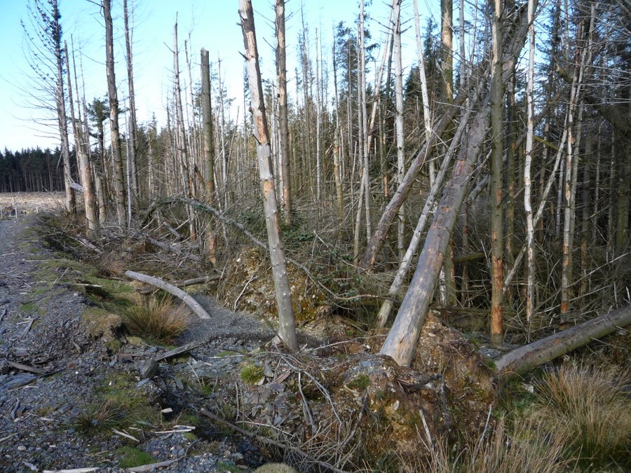
climb up Bradda Hill from the Fleshwick side.  For a change, we took the footpath around the east side of the hill below the little plantation and then went up the road to the Tower and climbed Bradda Hill from the south side. 

This is the view looking back towards Bradda Head and the Milner Tower with the Calf of Man beyond - from the path above the sheer drop down to the sea below Bradda Hill.


Then we reached the top of our second peak.  The pile of stones marking the summit of Bradda Hill.


Before descending the steep path to Fleshwick, I took this photo of Trevor near a wall where we often stop for a coffee break. The grass and heather are flourishing here now but there are still a few patches of moss and stonecrop which were the first to re-colonise the bare earth after the fire.


 A little further down the hill the grass and heather were growing even more vigorously.


This photo taken in late summer 2009 (nearly two years ago) from almost the same place shows how quickly the vegetation is regenerating.


Tim, Trevor and Danny on the path down to Fleshwick.


Walk was really arduous – a three hill walk.  It took four and a half hours.  I know I am very lucky to be healthy enough to go on these hikes but when I was struggling up the final steep climb from Fleshwick Bay to the Carnanes I didn't actually feel very lucky!  I couldn't complain though, because I planned the route.  We keep reassuring ourselves that the exercise is good for us but I sometimes wonder whether there is an element of masochism involved.  Anyway the views are always lovely.  

From the top of the Carnanes we could look across the whole of the south coast of the Island


Tuesday 22 March 2011

North Barrule

A birthday walk.

Tuesday 22nd March, 2011

Tim said he would like to go for a walk on his birthday and I made the mistake of asking where he would like to go.  Of course he wanted to climb North Barrule - starting from our house.  I am not sure why people choose a North Barrule walk so often.  It is quite an arduous climb from the glen because North Barrule is the second highest peak on the Island - 1860 feet - and our house is only about 150 feet above sea level. 

We crossed the mountain road above Brookdale plantation and started up the hill.  Below us we could see Skyhill, Ramsey and the northern plain.


Above us the ominously steep climb to the summit.


Eventually we reached the path which runs along the full length of the ridge and paused to look towards Snaefell.


Tim was going faster than I was!


But I caught up to take a photo of him and Leo on the summit.  The views were spectacular because the air was so clear that we could see all the surrounding coasts - the Mull of Galloway, the mountains of Mourne, the Lakeland fells and even the mountains of north Wales 


We stopped at the top to rest and admire the view.  Then we looked for a more sheltered place to have a small birthday party with coffee and cake. 


It was a magical walk.  My photographs don't do it credit because it was overcast on the mountain.   We saw quite a lot of white hares and Leo even chased one.  Needless to say, it was in no danger of being caught!  There were also the first skylarks singing overhead and we disturbed a group of golden plover on the hillside above Guthrie's memorial. 


In the afternoon I saw the first butterfly of the year in our back garden - a comma.

Monday 14 March 2011

Slieau Dhoo

Not the easy way!

Monday 14th March, 2011 

We parked at the entrance to Ballaugh Plantation near Ravensdale and walked along the track into Glen Dhoo until we reached the old farmhouse.


We crossed the old slate footbridge in front of the farmhouse.


(Update: The slate bridge across the stream has since been damaged possibly by the snow in March 2013.   When we walked this way in April 2013 it looked as though one end of the piece of slate had shattered - and most of the “bridge” was under water.)

Our intention was to walk up the footpath on the west side of the glen which runs diagonally uphill between the conifer plantation and the wooded area below but someone had the bright idea of cutting the corner and going straight up the hill on the southern side of the plantation.  This decision may have been my fault but was more likely to have been inspired by one of the men.  We survived but I don’t think I will ever try doing that again.  On the way up, I stopped and looked back into the glen below and thought “I should take the time to appreciate the view.  I will never see Glen Dhoo from this vantage point again.”

It was a lot steeper than it looks in this photo (looking north from the top of Slieau Dhoo) and we had to find our way through a patch of gorse before we reached the Slieau Curn track (above the plantation on the left hand side of the photo) and enjoyed slightly more civilised conditions underfoot.


There is a convenient hollow at the top of Slieau Dhoo which is perfect for sheltering from the wind and enjoying a coffee break. 


 We returned to the car through Ballaugh Plantation.  The trees at the top of the plantation are exposed to the south westerly gales and have suffered badly in recent years. 


(Another update:  The route that we followed through the plantation down to Ravensdale has been closed for a couple of years on account of extensive larch felling to reduce the spread of disease.)

Monday 7 March 2011

Slieau Ouyr


 Only one more hill crossed off the list

Monday 7th March 2011

We started from the parking area across the road from the Glen Mona hotel and climbed up the steep stony footpath behind the hotel.  It is possible to follow this footpath all the way to Black Hut on the mountain road, or to turn off into the Laxey valley via Agneash or the path down to the mines.

I didn’t take many photos on this walk – just a series of three to see whether I could pick out the site of Keeill Voirrey on the far side of the Corrany Valley.  It isn't easy to see but I think it is in the top left hand corner of the greenish patch in the centre of the photo.


When we reached a convenient firebreak that had been mowed in the heather, we turned off the footpath and headed for the top of the hill.  But as we approached the top we realised that we had turned off the footpath too soon.  Instead of being on Slieau Lhean, so that we could head east over the top of Slieau Ouyr and bag two peaks, we were on the top of Slieau Ouyr.  It would have taken us too far off course to double back to Slieau Lhean, so we left that hill for another day and carried on towards the Ballaragh Road.


 I am relying on my memory now and I don’t guarantee that it is 100% accurate as I am writing this nearly three years after the hike.  I think we headed east towards an area where the greenway road near The Clarum was being improved and then continued along the minor road to the Ballaragh Road.  After that we followed the minor roads which form part of the Raad ny Foillan until we reached the junction where the coastal footpath branches off to the right, down to the coast at Cornaa.  We carried straight on along the road until it reached the car park near the main road.