Saturday 25 May 2013

The Chasms

The sixth leg of the Raad ny Foillan - the walk of the beautiful bays.

Monday, 27th July, 2009
 
Unusually, the slowest section of Monday's expedition was part of the drive to the starting point  We met at Scarlett, left our car there, and drove back to the Chasms with Trevor and Dorothy.  As we drove up The Road to the Sound, past the road to Glen Chass, we were held up by a large herd of cows ambling up the hill.  I had no idea that cows walked so slowly.  The sheepdog, which was supposed to be helping to keep the herd moving, got so bored that he kept stopping to mark his territory.  Eventually, they turned off the road into a field and we drove on at a reasonable speed to the Chasms - where we were welcomed back by the choughs who were showing off in the air currents above the cliffs.
 
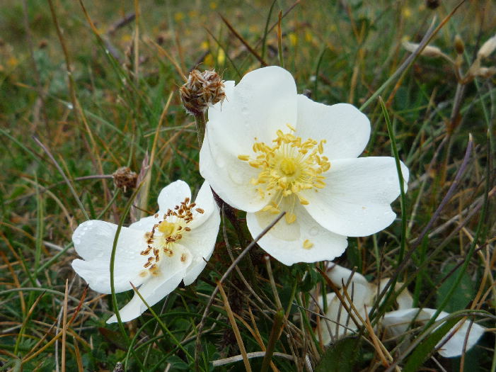
I stopped by the stone wall to take a few snaps of the heather growing around the chasms.


The others walked ahead and took the most direct footpath down towards Glen Chass instead of following the scenic route - so we missed the last spectacular views from the top of the cliffs east of the Chasms and the sight of the seabirds roosting on the Sugarloaf. 
 
But our route had its own charms and we were soon able to enjoy the view down into Perwick Bay, with Kallow Point and Port St Mary beyond - and beyond Port St Mary we could see the Bay ny Carrickey with the distant outline of Scarlett on the far side of the bay.


We continued our way downhill, along the back roads through Glen Chass.  I will never be able to walk through this part of the Island without remembering a cat that we encountered some years ago, when we were doing a circular walk from Port Erin, through Glen Chass and back along the coast.  I foolishly stopped to talk to this friendly ginger cat.  The cat must have been bored because it followed us.  I kept assuming that it would turn back soon - but it just kept going.  We didn't want to abort the walk and return to Glen Chass.  It was a really hot day and, by the time we reached the view of the Sugarloaf, the cat looked exhausted.  But it kept following us.  I ended up carrying it to the tearoom at the Sound - hoping that they would keep it for us while we walked to Port Erin and drove back to collect it.  They refused - but luckily one of the customers overheard the conversation and offered to take the cat back to Glen Chass in her car.  The cat would never have been allowed to join us if one of the Schippies had been in the hiking party.  They don't approve of strange cats.
 
As we approached the path above Perwick Bay, we were held up for a few minutes when we met a large group of elderly hikers coming from Port St Mary.  We had to wait while they passed though a gate.  Tim said that most of them were speaking French - so it must have been a group of tourists.  It occurred to me (very unkindly) that they were walking at a similar speed to the herd of cows that we encountered earlier.
 
We walked through the town and down to a cul-de-sac called The Under Way.   The tide was out and the boats moored in Port St Mary harbour didn't look as though they would be going anywhere for a while.


The Under Way led to a walkway which led to the promenade around Chapel Beach.


While we were walking along the promenade, I noticed a heron standing in the shallows.  While I was watching it, a herring gull swooped down in an aggressive way.  The gull came back three times.  Each time, the heron ducked and the gull circled back.  Finally, it got tired of bullying the heron and flew away.   This is the view back towards Port St Mary across Chapel Bay. 


From Chapel Bay, the route followed a road and path round Gansey Point to the largest of the beautiful bays - Bay ny Carrickey.   We walked across the vast expanse of flat wet sand.  Just us . . . and the sand and the sea and the sky, dappled with cloud. 


It isn't always such a peaceful scene.  When the tide is in and the onshore gales are blowing, the waves crash over the sea wall and flood the road above.  Huge boulders have been piled at the top of the beach to protect the sea wall.  I wanted Leo to pose next to them but he wouldn't oblige.
 
We turned off the beach before we reached the Black Rocks and walked along the pavement next to the main coast road past Kentraugh.  Many years ago we saw some llamas in a paddock at Kentraugh but there was nothing to see as we walked past on Monday - apart from a life-sized fibre-glass cow.
 
Leo did not enjoy the walk along the pavement.  He kept looking over the low wall - staring longingly at the shore.  Eventually we got to Strandhall, left the noisy traffic behind us, and turned off along a narrow road which passes some expensive properties and a farm and ends up at the Poyllvaaish Quarry.  There was a flock of goldfinches feeding on the weed seeds at the side of the road.  Then Dorothy noticed a couple of convenient benches and we stopped for a late tea break.  It was very pleasant, to relax for a few minutes in the sun and enjoy the view back across the bay.


The final stretch of the walk was along the footpath from Poyllvaaish to the parking area near the Visitor Centre at Scarlett.  We met two women who were walking along the path, killing time until the Visitor Centre opened at 2 p.m.  They asked about footpaths in the area.  One of the women was keen to continue and do a circular walk back to the Centre.  The second woman said "I think I will go back to the car" and then corrected herself, "No . . . I know I will go back to the car!"  She then told us a story about a boat trip to the Calf - many years before.  The sea was so rough that she was convinced they would all perish - so she offered to refund all the other passengers . . . as long as they agreed to return to harbour immediately.  They agreed.  I doubt whether she was a descendent of one of those intrepid nineteenth century ladies who travelled the world and wrote about their adventures.
 
    The last photo shows the path approaching the old coast guard tower near Scarlett Point.  A few years ago, while granddaughters were visiting the castle and I was killing time here, I saw some clouded yellow butterflies on the wild flowers growing in the shelter of the limestone wall.  I hoped I would see some more on Monday but I was out of luck.  But, we had seen three small tortoiseshells earlier in the day, and there were some common blues by the path past the fields as well as the ubiquitous whites and meadow browns that we see on most walks.


I was musing about the number four towards the end of the walk.  Four climbs last week and four bays this week - and then we rounded the point and there was a fifth bay - Castletown Bay!
 
We have passed the half way point in our journey round the Island . . . and next week we will be heading north.

Fleshwick

The fifth leg of the Raad ny Foillan - The way of the chough
 
Monday, 20th July, 2009
 
Monday was another gusty day.  I think we are so sheltered in Glen Auldyn that we are bound to be impressed by the blustery weather on the south-west coast of the Island.  I am always grateful that the prevailing winds are onshore because it would be terrifying to be blown towards the tops of the cliffs.
 
This section of the coastal walk is the most impressive of the whole coastal footpath - rugged scenery and spectacular cliffs.  I love looking down to the sea, and having a "bird's eye view" of the gulls flying way below us.  It always reminds me of our first walk on the Island - my first cliff walk ever - from Glen Maye to Peel.  On Monday we kept hearing the distinctive call of the choughs - handsome black members of the crow family with bright red beaks and legs.  They are quite common on the Island and we like to brag about them because they are fairly rare on the mainland.  They are mainly seen flying above the cliffs, where they nest.  Their aerial displays confirmed the opinion of my bird book, which says that they are "masters of aeronautics".
 
 "The tough one - part 2" came a close second in this week's competition for a title for the walk.  There was no single climb to compare with Cronk ny Arrey Laa last week - but there were four notable climbs - and according to Tim's pedometer this leg of the walk was about eight and a half miles. 
 
We started from sea level at Fleshwick Bay and after a short walk up the road and a stroll along the edge of a barley field, we tackled the first climb up the north side of Bradda - for the second time this year.  I thought of attaching a photo taken from the barley field but it didn't give an accurate impression of the steepness of the path - so I chose one taken from the top of the climb instead . . . looking back at the farm near the road above Fleshwick.  In the foreground you can see how well the heather is growing back in the area which was burned a few years ago.  Dorothy was just approaching the top of the hill when I took the photo because she had stopped on the way up to take photographs - and had been waiting for a patch of sun to light up a particular part of the view.  The clouds were moving so fast that she didn't have to wait long.


I thought of trying to record the difference in vegetation on either side of the "big burn" line, but the men were obviously trying to reach the stone wall at the top of the climb without stopping for a rest.  I had never managed to do that before, decided that it was "now or never", and plodded up after them.
 
This is the view back towards Bradda Hill from the path towards Bradda Head and Milner's Tower. 


This area seemed to be very popular with local dog-walkers.  First we met a woman who thought she had lost her dog - but it turned up quite quickly.  Then we passed a couple with two large dogs on leads.  One dog was well trained but the other dog barked aggressively at us as we passed.  Dorothy muttered "The owner said it wouldn't touch me . . . but its teeth missed my hand by half an inch!"   Then near the tower, we met a very talkative local man with a couple of dogs.  He insisted on explaining our route through Port Erin (which we already knew) in great detail.  He warned us about head-high heather by some of the paths - which intrigued me.  Well, it turned out that he was half right.  The vegetation was head-high (even for Tim) but it was bracken not heather.
 
Port Erin beach has always been a favourite destination of the granddaughters.  On Monday, the beach was almost deserted.  The only living souls in view were a few herring gulls at the edge of the water.


We started the second climb, up Mull Hill, along the path which starts behind the Marine Biological Station and climbs the hill past the house where Nigel Mansell used to live.  He had a running battle with the local authorities after he created a huge earth bank to act as a wind break on the west side of the house.  Part of the bank remains but I think it was reduced in size.  Not long after the row, Nigel Mansell sold up and left the Island.  I don't know whether his decision was influenced by the disagreement.  There is a lovely view of Port Erin Bay from the path up Mull Hill.  The V in the hills behind the bay shows the start of our walk - Fleshwick - between the Carnanes on the right and Bradda on the left.


The next section of the path - shortly before reaching the Sound - is the roughest part of the walk.  We stopped here for a tea break and were joined by an unusually polite herring gull.  He perched on a nearby rock and watched hopefully until we continued the walk. 


We didn't see any basking sharks this week but we did spot a couple of distant seals on the rocks between the Sound and the Calf.  The strength of the currents between the main island and the Calf was obvious from the choppy water and it was easy to see why this used to be a notorious place for wrecks.


We left the Sound and approached the third climb - up Spanish Head.  The next photograph shows the imposing bulk of the cliffs at Spanish Head, photographed from Burroo Ned, a promontory between the Sound and Spanish Head.  Burroo Ned is the site of an Iron Age fort with a rampart on the landward side. 


I had to rush up Spanish Head to catch up with the others, after stopping to take photographs on Burroo Ned, but it was worth it.  The views from the top were stunning. The final photograph shows the view back towards the Sound taken from the path down the east side of Spanish Head.  The cairn on the top of the hill is just visible near the right edge of the picture.    The new tearoom and the parking area at the Sound are hidden behind Burroo Ned on the left-hand side of the picture.  The bell heather was colourful but it was a bit too early for the ling (Scottish heather) and western gorse. 


And finally - the sting in the tail of the walk.  There was one more long climb to negotiate.  It is easy to forget that the path drops down a long way between the top of Spanish Head and the beginning of the climb up to the Chasms - and the climbs at the end of a walk always seem longer than those at the beginning.  But we survived!  And the next section of the walk from the Chasms to Scarlett is either downhill or almost flat.  It is hard to believe.

Monday 20 May 2013

Dalby

 Fourth leg of the Raad ny Foillan - The tough one.
 
13th July, 2009
 
The weather didn't look very promising on Monday morning.  There was a blustery wind, occasional showers had been forecast, and it was raining in the Glen when we left home.  Then we drove though dense fog on the road between Round Table and the Sloc.
 
Our hike started in intermittent sunshine, along the coast road through Dalby and then down the second road to the right.  The first right would have taken us down to the beach at Niarbyl, but our route went along a narrow road, which our neighbour in Ballure Grove used to call "bedstead lane" - because the fence at the top of the bank above the road was patched with the remains of old iron bedsteads.  The "bedsteads" are still there, I picked out two, but they were almost hidden by the brambles.  There are some expensive-looking properties down the lane but one drawback of living there was illustrated by the group of wheelie bins near the junction with the main road.  The lane is obviously too narrow for the rubbish lorries, so all the inhabitants have to tote their garbage up the lane to their bins at the top of the hill.
 
After crossing a stream in the valley we walked up towards Eary Cushlin, along an old bridle path which has been eroded down to rock and rubble.  The others are toiling up the hill but Danny is looking back, wondering why I have stopped.  Schippies are very clever but they don't understand photography. 


About half the way up the hill we climbed over a stile and followed a footpath towards the sea, and then around the bracken-covered slopes above the shore.  In the photo you can see the western side of the Carnanes and Bradda Head with the entrance to Fleshwick Bay - our destination - between them.  In the far distance you may be able to make out the faint outline of the Calf.  The cloud obscuring the top of the Carnanes was a bit ominous because we had to climb Cronk ny Arrey Laa (Hill of the Day Watch) before we reached the Carnanes and that is considerably higher.  We had hoped that the fog might burn off towards midday but it seemed to be taking its time.


Our path took us across a narrow ravine below Eary Cushlin, not far above sea level, and then we had a long slog uphill.  First up towards the old farmhouse and then up into the clouds.  The summit of Cronk ny Arrey Laa is 1434 feet above sea level and this bit of the walk is uphill all the way - which is why Linda still remembers this section as being the toughest leg of the coastal footpath . . . and it is quite a few years since we last did the whole Raad ny Foillan.  Linda hoped to join us on the hikes after her visitors left but hasn't been able to as she has been suffering from back problems.  Tim and Trevor are disappearing into the mist on the path through the heather on the north side of Cronk ny Arrey Laa.  Danny is still checking up on me.


We stopped for a tea-break - trying to shelter from the cold wind behind the cairn on the top of the hill.  It is hard to believe that this photograph was taken in the middle of summer.  Instead of a wonderful view, we could only see a few yards which was quite disorientating. 


It wasn't easy to decide which direction to head in after the break.  There are four paths leading from the cairn and only one had a rather ambiguous footpath sign, so we had to take an educated guess.  On the way down we met two hikers who were visiting the Island and doing the Raad ny Foillan in the opposite direction.  We asked whether they had come up from the Sloc but they had never heard of the Sloc - however, they had heard of Fleshwick and confirmed that we were on the right path which was good news.  The visiting hikers were walking all the way from Port Erin to Peel on Monday which made our short  "tough" fourth leg seem rather paltry in comparison.
 
The next climb was up the steep slope of Lhiattee ny Bienee from the Sloc to the fairly level path along the top of the Carnanes.  You can see the southern side of Cronk ny Arrey Laa behind with its "tablecloth" still obscuring the summit.  The furthest headland is Niarbyl - the tail of rocks - below the road where we started this section of the walk.


    And finally, we reached our destination . . . Fleshwick Bay with next week's first climb (up the back of Bradda) ahead.   Although the big fire on Bradda was some years ago, the bracken hasn't grown back yet and it is easy to see the extent of the burn.  The green patches are mainly bracken which escaped the flames.  The sun was shining, we were sheltered from the wind - and suddenly it really felt like summer again. 


As we drove back to Dalby the cloud finally dispersed and we were able to see the top of Cronk ny Arrey Laa.
 
    Next week - Fleshwick Bay to the Chasms.

Peel

The "new and improved" third leg of the Raad ny Foillan (featuring the basking sharks)
 
8th July, 2009
 
We started off from St Germain's Halt, and walked along the main coast road towards Peel, until we reached the footpath which follows the top of the cliffs north of the town before descending to the promenade.  Before we had even reached the gate to the footpath, we met a dog-walker coming up the road who told us to look out for basking sharks - and as soon as we got a good view down into the sea we saw one.  We kept sighting them as we walked towards Peel but weren't sure whether we were seeing a series of basking sharks or the same one which just happened to be moving south with us.  I took a number of photographs but they weren't very clear - just a lot of water and an indistinct fin or two!  South of Peel Hill we saw one closer to the shore and I got a better photograph.  At least it is possible to make out the shape of the shark through the water.


The first photograph of the day shows one of the stacks below the cliffs and illustrates the truth of the old saying "Birds of a feather flock together".  All the cormorants are perched on the lower section and the gulls are up at the top.  I think this might be the largest of the red sandstone stacks north of Peel, which is marked on the map as The Stack.  The gulls nest on the stacks and it can be quite scary walking along the path in spring because they tend to dive down and attack passers-by who get too close to their chicks.


This is the very civilized footpath that we walked along - smooth and with neatly strimmed edges.  The familiar outline of Peel Hill and St Patrick's Isle are in the background.  There was a gusty wind blowing and it was difficult to hold the camera steady.  The wind also accounts for the lack of flower photographs.  I was disappointed not to get a shot of the first harebells of the summer but they were being tossed about in the wind and all I could have hoped for was a blue blur.


Now an explanation of the "new and improved" comment in the title.  This is a view of Peel harbour and the new marina taken from the pedestrian swing bridge, across the mouth of the Neb.  The bridge joins the southern end of the promenade to the road leading round the harbour to Fenella Beach and the castle.  The classic route for the Raad ny Foillan follows the road on north side of the harbour as far as the kipper factory and then crosses over the road bridge onto a steep footpath leading up to the saddle between Peel Hill and Corrin's Hill.  We decided to cross the new pedestrian bridge and take a less steep path which linked up with the other route near the top of the hill.  We rationalised that the coastal footpath would have followed our improved route if the pedestrian bridge had existed when the Raad ny Foillan was originally planned.


I missed another action shot on this walk.  Leo noticed something moving in the undergrowth at the side of the path over the hill.  His hunting instinct proved more powerful than his natural caution and he jumped into the middle of a small gorse bush.  Then he decided that it would be less painful to stay there rather than try to extricate himself - so Tim had to step in and rescue him.
 
We continued along the path which crosses the south-west side of Peel Hill.  There is a steep drop down to the sea and my mind boggled when Trevor said that there used to be a railway line along this path.  It must have been a long time ago because he said it was used to transport stone from a quarry to build the Peel breakwater and that the trucks were pulled by horses!  It was a little further along this path that I took the photograph of the basking shark.


    The last photograph shows the "path" between Peel Hill and Glen Maye.  No strimmers have been here this year - and the path has practically disappeared from sight beneath the long grass.  We met two hikers heading towards Peel from Glen Maye and they said that they had seen three or four basking sharks in the sea off Glen Maye.  I managed to pick out a couple but they were further offshore so I didn't take any more photographs.


    Instead of taking the path which goes as far as the old water wheel casing, and then walking down the track to the shore, we took a short cut down a steep path to the beach at the mouth of the river at Glen Maye, crossed the bridge and climbed up the other side of the glen to some fields below the Dalby Road.  The last bit of footpath before we reached "civilization" was so overgrown that the weeds were head height and Leo decided that it would be easier to walk behind me than to go in front and push his way through.  Luckily it was only a short way until we reached the houses and then we walked along the road as far as the car. 
 
The only thing of interest along the last stretch was spotting a small tortoiseshell butterfly at the side of the road.  They used to be quite common and we had them over-wintering under our house when we first moved to the glen but it is quite a rare occurrence to see one now.  It is odd how the populations of the various butterflies fluctuate over the years  I used to get excited if I saw a comma or a peacock but we see them every summer now.  Dorothy was complaining last week that she hasn't had any butterflies on her buddleia this year but we think it may be due to the buddleia flowering earlier than usual after our "heat-wave".

Saturday 18 May 2013

The Cronk

The second leg of the Raad ny Foillan - a cheats version

 29th June, 2009
 
We were a bit apprehensive about walking on Monday because of our "heat wave" - maximum temperatures of 24 degrees most days.  I know 24 won't impress you but it is a heat wave for us!  We left all the dogs at home again.  Partly because of the reasons given last week and partly because of the lack of shade on most of the walk - little black dogs heat up fast in the hot sun.  But it actually turned out to be quite a pleasant morning, slightly hazy and a bit of cloud cover, with cool breezes on the beach. 
 
I was glad that I captured an image of the blue and distant Peel hills at the end of the last walk because they were barely visible when we set out on the second leg.  The first part of the walk was along the beach from the Cronk to Glen Trunk.  There wasn't much to photograph except a lot of sand and the eroding clay cliffs which are being worn away from above by run off from rain on the fields, and from below by the waves when onshore gales and high tides coincide.  Add in wind erosion and, over the years, whole fields as well as buildings have been lost to the sea in the north of the Island.


The second photograph shows the new bridge over the stream at Glen Trunk just a few yards from the beach.  When we moved to the Island, there was a charmingly eccentric bridge at Glen Trunk.  It consisted of the chassis of an old truck and a few planks.  This was replaced by a boring wooden bridge which was washed away during floods last year.  The third bridge, with its blue "Raad ny Foillan" sign, is much higher above the water so it may survive a bit longer. 


I could call the last photo "A Raad not taken" because Trevor decided that there was no point in following the "classic route" which leaves the beach and follows the footpath over the bridge to Bishopscourt and then goes along the old railway line to Glen Wyllin, where we should have returned to the beach until we reached Glen Mooar.  Trevor said it was supposed to be the coastal footpath - so we should stick to the coast and follow the shorter route along the beach.  As Trevor is the only member of the group who hasn't done the whole walk before, and we are doing it mainly for his benefit, it seemed right that he should decide.  And it was tempting to cheat a bit and take a short cut along the shore because the tide was a long way out and there was flat, hard sand to walk on.  The haze was lifting and Peel hill was visible again but it still looked rather a long way ahead.


   We stopped for a break at a picnic table at Glen Mooar and then walked up to the old railway line.  The path climbs up the steep embankment near the old sandstone pillars which carried the railway bridge high above the glen.  The bridge is long gone but the pillars remain as a monument to the good old days.  It was getting hotter and hotter as we walked along the old line and at first there wasn't much to photograph except plastic covered hay bales and fields of bored sheep.  There were quite a few uncooperative butterflies, which wouldn't settle long enough for a photograph, a couple of painted ladies and one or two unidentified whites, but mainly a lot of meadow browns, and some common blues and small heaths.  The larvae of the last three all feed on grasses and there was plenty of grass around - but very few wild flowers.  We passed a patch of spearwort (type of buttercup) and some wild forget-me-not growing in a damp ditch but they weren't very photogenic.   Then we reached the rather boggy section of the track near Bobby's farm, where we had to pick our way around or through patches of semi-liquid mud, and the vegetation changed completely.  First there were some colourful patches of Rosebay Willowherb and a lot of white hogweed by the rather overgrown path . . . 


. . . and then we came across a whole lot of beautiful orchids.  I thought at first that they must be marsh orchids but, after checking photographs on the internet, I think it is more likely that they are common spotted orchids.  It isn't easy to identify them positively because they are quite variable and frequently hybridise.


    The last photo was taken as we approached the end of the walk and features some calves.  They seem to be oblivious of the beautiful view of Peel Castle from their field.  (It also shows the first part of next week's route, which follows the top of the cliffs north of Peel and then goes through the town and over Peel Hill.)


    Eventually we reached the car which we had left at St Germain's Halt, where the old railway line crossed the coast road.  There must have been a level crossing there when the trains were running but the name is still used by a rather interesting private home built of red Peel sandstone.   Originally it was the old station building - but it has been extended and modernised.  Trevor lives in Peel and knows the surrounding area very well.  He suggested parking there.  It is a better place to leave a car than the sand quarry where we had planned to stop and which is at least half a mile further on.  So we managed a second "cheat" - but that half mile will be tacked onto the beginning of the third leg.   Next week - St Germain's Halt to Dalby.

Point of Ayre

From the Lighthouse

Monday, 22nd June, 2009

    The walk on Monday - which I have called "From the lighthouse" so that I can be clever and call the final stretch "To the lighthouse" - started in cool, cloudy weather but got hotter as the walk progressed.   We started from the most northerly point of the Island.  The lighthouse was built between 1815 and 1818 by Robert Louis Stevenson's grandfather. 


The first stretch was along the path above the edge of the shingle beach and then we had a long walk through the Ayres Nature Reserve and on to Blue Point where the path ended and we had to continue along the beach.

    It was a real nature walk with masses of wild flowers on the Ayres, and seabirds on the shore, and the occasional seal popped its head out of the water to stare at us.  I was annoyed that I hadn't taken a notebook and pencil because there were so many different types of flowers that I identified that I was sure I wouldn't remember them all.  I counted at least 28 different species but I only allowed myself to photograph two - some early burnet roses . . .


. . . and a few pyramidal orchids. 


Most of the flowers on the Ayres would be difficult to photograph because they are tiny - almost like bonsai versions of the normal plants, mainly because of the constant wind - but also because the sandy soil doesn't retain many nutrients - and the salt probably stunts their growth too.  This photograph shows the path through the marram grass approaching the old coastguard lookout point perched on the end of the Bride hills overlooking Blue Point.  The white building with the slate roof is the clubhouse of the clay pigeon shooters.


    There were skylarks singing on the Ayres and we saw a couple of curlews and some ravens.  On the beach there were the usual herring gulls, a couple of greater black-backed gulls, one cormorant, and groups of oystercatchers all waiting to feed on the wet sand when the tide turned.  The oystercatchers amuse me because they sit around in groups as though they are having an earnest conversation or a serious committee meeting.  As we approached they would start to dither around in a distracted way and then suddenly take off - with an amazing display of precision flying that puts the Red Arrows to shame.  They must be a bit stupid though, because they would invariably land further up the beach ahead of us - so that they were disturbed again when we caught up with them. 

    We stopped on the beach for a tea break in perfect isolation apart from a nosy seal which swam past.  The going was quite tough along the beach because the tide was in and we had to choose between walking on soft, dry sand or picking our way through piles of seaweed at the edge of the water.  There was a bit of excitement when we reached the end of the Lhen trench - a drainage canal.  There isn't usually a problem crossing it because the water spreads out across the beach - but there wasn't much beach because the tide was still high and, judging by track marks on the sand, the trench had recently been dredged.  It was only a few feet deep but was just too wide to jump over.  I took off my boots, rolled up my jeans, and waded though, managing to step over the deepest part.  I was too late to take an action photograph of Trevor, who decided to jump.  He almost made it but ended up with wet boots.   Instead, I took a less dramatic photo of Tim and Dorothy preparing to wade through the water.


    On the way from the Lhen to the Cronk we were due to pass the remains of a wreck which is underwater for most of the time but can be explored at low tide.  Dorothy said that we might be able to see the top of the wreck because the tide was going out.  As we approached the area where we thought the wreck was located, I saw something dark sticking up out of the water.  We thought it might be part of the wreck and, as we got closer, I said to Dorothy that I would have guessed that it was a seal if it hadn't been in the same place for such a long time.  As I said that it moved!  At first we thought it might be a bird sitting on the top of the wreck and then we realised that it was too big.  We watched it for some time and Dorothy took some photographs and in the end we decided that the only explanation was that it was a seal and it was staying in the same place because it was sitting on something - either a submerged rock or part of the wreck.  By the time we reached that conclusion, the men were a long way ahead.

 This is the final bit of the walk - Tim and Trevor are approaching the Cronk and Dorothy is trying to close the gap.  The faint blue hills in the far distance are Peel hill and Corrin's hill and they look an ominously long distance away.  The next week's section of the footpath will take us from the Cronk to the sand quarry just north of Peel where there is space to leave a car at the side of a minor road.


    We didn't take a dog on Monday's walk because the terns nest on the northern beaches and there are also a number of birds, such as skylarks, curlews and lapwings, nesting in the undergrowth on the Ayres.  Dogs are allowed as long as they are on the lead, but it is probably best to keep them away from the Ayres at this time of year.  I will probably leave them at home next week too because there will be a fair amount of beach walking again - and they sometimes eat rubbish on the beach or roll on something nasty.  It wouldn't be much fun driving back from Peel with an extremely smelly dog in the car (especially if it has eaten rubbish and throws up!).

Introduction

 
Introduction
 
Back in 2009, in the olden days when my first digital camera was still young and frightening, we planned a walk around the Island.
 
In midwinter, January 2010, I sent an email to my sister in Canada " . . . during the summer and autumn we walked the Raad ny Foillan (The Way of the Gull - or The Coastal Footpath) - with some friends.  It is about 95 miles in all and we divided it up into twelve sections and aimed to walk one section each week.  It is debatable who suggested the enterprise.  I remember sitting on top of Bradda Hill in early spring with Tim, Dorothy and Trevor, and saying that we should walk up there again in summer when the wild flowers were in bloom.  Dorothy responded and said why didn't we walk the whole Raad ny Foillan again - and then we got involved in a discussion about whether to go clockwise or anti-clockwise.  When we returned home I told Linda about the proposed walk.  Perhaps my memory is defective because later everyone (except me) seemed to think that they had personally come up with the idea!
 
    We started after TT, without Linda.  She had visitors and said that she didn't mind missing the first couple of sections which involved a lot of tedious beach walking.  After her visitors left, Linda had a variety of minor problems including a bad back and didn't join us until the last stretch along the beach from Ramsey to the Point of Ayre.  We didn't finish until late autumn because we missed a few weeks when our friends were off the Island."     
 
I had taken photographs on walks before but this was the beginning of the "walk emails" which were written partly for myself as a way of preserving memories; partly for Linda as a consolation for missing most of the fun; and partly for long-suffering relatives scattered around the world who might - or might not - be interested.
 
Now I am starting the mammoth task of tidying up the photographs, which were originally smaller and sent as attachments, and transferring the emails to a blog.
 
I had various ideas for a title - including a play on the words Moddey Dhoo (a scary black dog which is believed to haunt Peel Castle) but decided on Memories - because this is really just a collection of happy memories.
 
A Moddey Dhoo - Spring in Ballaglass 2009 - Alexander amongst the bluebells.