Tuesday, 18 September 2012

Groudle

Another triangular walk
 
Tuesday  18th September, 2012
 
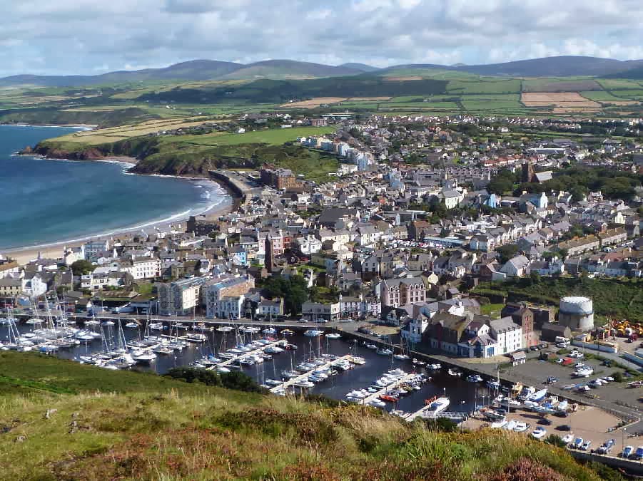
    Another triangular walk, this time on the east coast - starting at Groudle Glen just north of Douglas, near the shore.  
 
    Continuing the theme from last week, we decided to do this one "in reverse" as well, starting along the footpath next to the Groudle River instead of the usual direction up to Conrhenny via Baldrine and then back past the dams and along the river.  A change of direction changes the walk more than one would expect.  The views ahead differ and also I tend to pay more attention to the first part of the walk.  Towards the end I am just concentrating on surviving until we get back to the cars.
 

    It was very pleasant ambling alongside the river in the sheltered glen, particularly because the first part of the footpath had been repaired.  It used to be very muddy and parts had been almost washed away during the last floods.  We were amused to come across this fellow . . .


. . . he had been carved from the trunk of a conifer growing between the path and the stream.  These carved figures seem to be springing up everywhere.  The first ones that we saw were in Sulby Glen, but on the last walk we saw a carving of "Fenella", a Walter Scott character, above the Fenella Beach car park, gazing across the causeway towards the site of her famous fictional leap from the castle walls.
 
    The path through the glens goes under two bridges.  The first is a combined bridge for the road to Onchan Head and the Manx Electric tram line.  I don't know when it was built but it is likely to have been towards the end of the nineteenth century.  The tram from Douglas to Laxey has been running since 1894.  Old bridges always seem to be much more attractive than the modern concrete designs.


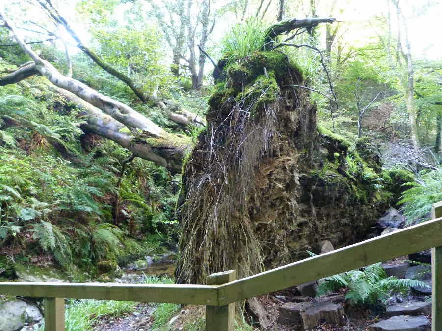
    Nature has also tried to bridge the stream.  There were a series of old trees that had been uprooted in the winter gales  - very tempting for an adventurous child to climb across.


    After passing under the second road bridge we left Groudle Glen and entered Molly Quirk's Glen.  A popular story on the Island is the the Glen was named for a rich woman who was robbed and murdered near the river.  Her ghost is said to wander through the glen.  There is no evidence for the murder story . . . and we encountered no ghosts (not even a wooden carving of a ghost!)
 
    When we reached Little Mill Road, we had to leave the footpath and walk up the tarred road towards the dams.  I saw the first Goldenrod flowers (Solidago virgaurea) which we have encountered this summer.  Their stems were rather floppy - not at all rod-like - because they were growing on the damp and heavily shaded banks at the side of the road.  The only other place that I have seen wild Goldenrod is on a wall near Ballure Bridge.


 Further on we caught our first glimpse of Kerrowdhoo Dam, the lower of the two dams.


    Then we walked past the higher dam, Clypse.  The dark water isn't polluted.  It is stained by the water seeping down through the peat on the hillsides.  I have never seen the dams as full as this before - and this should be the driest time of year before the winter rains start!


    Over a stone wall, I saw a group of horses in a field.  I am sure these must be some of the horses that pull the trams along Douglas Promenade as I have heard that they spend their winters up here.


    We walked up the boardwalk above the dams until we reached the stony road that leads up to Honeyhill.  Then we took the path across to the Conrhenny Road.  This turned out to be a mistake.  It was more like a boggy stream than a path.  While I was checking the Molly Quirk story, I came across a comment on a "glenology" website by someone who was amused about the term "river" being used for the smallest of streams on the Island.  He wrote "You . . .  notice that anything with water in it is a river on Mann."  Well, using that definition our footpath definitely qualified as a river.
 
    The only good thing was coming across a nice patch of Devil's-bit scabious (Succisa pratensis) at the side of the path.  The wind was coming up and tossing the flowers around, so I had to take this photo while I was holding the flower stem with one hand and the camera with the other.  The Devil's-bit scabious is similar to the Field Scabious that we saw by the Peel to Douglas railway line about a month ago, but lacks the larger ring of florets around the edge of the flower.


    As we approached the Conrhenny plantation, I looked back towards Douglas Head.


    And the last photo that I took was of an unusually civilised refreshment break at a convenient picnic table by the Onchan Millennium  Cross.


    After that it was downhill all the way, along not very photogenic roads and a narrow footpath, back to Groudle.  I had thought of taking a detour to the quaint Old Church but it was getting late and clouds were gathering.  We had avoided the predicted scattered showers for two weeks and didn't want to push our luck too far.  Luckily we just managed to finish the walk before the rain came - but drove through a couple of showers on the way home. 
 
    No photo walks for the next couple of weeks.  Trevor and Dorothy are off on another trip to the mainland.  I think they have photographed everything on the Island so many times that they have to travel across now to find fresh subjects!   I asked Dorothy about this and she replied "We photograph the same things . . .  but different!"


Tuesday, 11 September 2012

Peel

A blue skies walk . . . with a sting in the tail!
 
Tuesday 11th September, 2012
 

The predicted weather for Tuesday was "changeable", a favourite term with the local met office because it covers most possibilities.  It usually means windy with rain showers - so we chose a low level walk.  We decided to repeat the walk that we did at the end of January - starting near Peel Castle.  But this time we did the walk in reverse and started out in a northerly direction, across the footbridge which links the castle and the town, and then along the promenade to the sandstone cliffs beyond the town.  The wind was fairly strong but not as bad as we expected and the sky was almost cloudless!


I was concentrating so hard on trying to zoom in on these cormorants, sunning themselves below the cliffs, that I failed to notice a man with a large black dog approaching along the path behind me.  Danny wasn't on the lead and he usually reacts very badly to strange dogs, but for once, thank goodness, he behaved well and just stepped off the path to let them pass. 


    A the end of the coast path we crossed the main road and walked up a small side road to the old railway line. The footpath along the railway line was very wet, muddy and slippery.  Not as bad as ice - but we had to walk carefully at times.  We stopped for a while to watch some swallows flying over a large puddle in a field.  These huge puddles always make me think of the golfing term "casual water".  They are almost like small shallow lakes which disappear after a dry spell.  I tried to photograph the swallows but they were flying far too fast.  They won't be with us for much longer as autumn is almost here.
 
    The scenery was more typical of spring than late summer/early autumn.  Only the bales of hay in these fields gave a clue to the season - but the mowed grass was already bright green again.


And there were other clues to the changing season.  The bright red fruits on the hawthorn won't last long.  The flocks of fieldfares and the blackbirds will see to that.


Picking our way carefully around the muddy margins of the puddles, heading back towards Peel. 


It was warm and sheltered along this part of the path - not a breath of wind to disturb the surface of the dark, boggy pools under the willows alongside the path.  I couldn't resist this reflection on the water which resembled an upside down tree.


After leaving the railway line we came to the uphill part of the route.  At first the gradient was fairly gentle, through farmland  and past Knockaloe.  Over a hedge, I glimpsed a huge flock of gulls on a newly ploughed field.  I thought they must be feeding on the upturned worms and insects but, when I got home and saw the photo on the computer, I realised that most of them were just sunbathing.  They were also enjoying the unexpected warmth.


The only drawback with hiking the route in this direction is that by the time we approached the steepest part of the walk we had already been on our feet for at least three hours.  My legs were aching as we climbed up the back of Peel Hill and I stopped for a short rest.  Tim took this photo of me, while I was seeing if I could identify all the hills on the horizon . . . .


. . . and he also took this one when we eventually we reached the top of the last uphill stretch after the little dip between Corrin's Hill and Peel Hill.


After that it was downhill all the way - with views of Peel on our right.  All the expensive boats in the marina seem to indicate that the richer section of the population haven't been affected too badly by the recession.


    The only "changeable" thing about the weather was that it changed for the better instead of becoming worse.  But the good weather didn't last.  We had a couple of showers about half an hour after we got home.
 

Wednesday, 5 September 2012

North Barrule

Nearly climbing North Barrule -
 
Wednesday  5th September 2012.
 
    It was a warm, calm sunny morning in the glen and I was worried about being too hot on the walk and dressed accordingly - but I couldn't have been more wrong.  It was not a good day to climb the North Barrule ridge with only a light fleece jacket and no hat.  I had intended taking a sun hat but forgot to pick it up on my way to the car.  A woolly hat would have been far more appropriate.   When we reached the car park at the side of the mountain road at Black Hut, we were greeted by a strong, cold wind and the sight of thick hill fog along the top of the ridge.
 
    There are four peaks along the ridge - Clagh Ouyr at the southern end, then two lower peaks, Ben Rein and Cronk ny Choree Farroghan (which are not named on the maps), and lastly North Barrule.
 
    We started up the steep climb to the top of Clagh Ouyr.  I hoped the exercise would warm me up but the wind got stronger when we reached the top and it was uncomfortably cold. 


    We trudged along through the cloud for almost an hour until I got fed up with waiting for the sun to burn off the fog and suggested to Dorothy that it might be a better plan to climb down into the Corrany valley.  Tim took this photo of Alexander waiting for me during the discussion with Dorothy.


He also took this one of Trevor leading the way down the hillside towards the sunny valley.


I had been too impatient, of course.  By the time we approached the bottom of the hillside, all the fog had disappeared - but we were more sheltered from the strong wind which was a bonus.  The small "white spot" on the side of the far peak of North Barrule (in the next photo) was caused by the sun reflecting off a plaque which was recently erected to mark the site of a plane crash during WW2.


We stopped for a tea break after we passed a lonely sheep pen in the valley.  In the past this valley would not have been so quiet and deserted because there are extensive abandoned mine workings down by the river.  Nearby, the remains of Keeill Voirrey (Mary's chapel) and a small graveyard also indicate that there was once a local population.


And finally - before the descent to the cars - the long trudge up the valley and around the south side of Clagh Ouyr.


Tuesday, 21 August 2012

Greeba

An upside down sort of Greeba walk
 

Tuesday 21st August, 2012

On Tuesday we arranged to meet in West Baldwin village to do our "Greeba walk" . . . hoping to enjoy the heather up on the hills.  We usually walk from West Baldwin because it is difficult to park closer to the footpath up Cronk Breck, which we use to approach Greeba Plantation and the mountain above. 
 
It was warm and sunny at home and Tim decided to drive to West Baldwin via the Mountain Road - but we hadn't gone far before we drove into dense fog on North Barrule.  The fog persisted all the way until we reached Injebreck House near the bottom of the West Baldwin valley.
 
We set off, hoping that the sun would burn off the hill fog before we reached Greeba plantation but the tops of the hills were still covered with a dense "tablecloth" as we walked up the road towards Cronk Breck.  There is a footpath from the top of this road which leads towards the plantation on the left of the photo.  The right of way turns downhill and ends near the house at the corner of the plantation.  There is no legal access to the plantation but we have always walked along a path used by mountain bikers, above a stone wall along the edge of some rough ground.  It leads to a gate into the plantation just above those beige-coloured fields behind the house.  


As you can see the mountain was still covered with dense fog/cloud as we approached the plantation.  We decided that it would be a better plan to forget about the invisible heather and walk down through the plantation instead of up into the fog.


The path we were following was very wet and overgrown.  It looked as though it hadn't been used much recently.  We also noticed that one of the fields that we passed had been ploughed and cleared of gorse so hikers may not be tolerated along this route much longer.  We reached the gate into the plantation and crossed the stream . . .


. . . and then turned down a forestry track towards the main road from Douglas to Peel.  The path followed the edge of the plantation and we had a pleasant view across the fields in the valley to Crosby.


The trees in Greeba plantation, which is sometimes called the King's Forest, are mainly conifers but there were some lovely old beeches by the path too.


After reaching the main road, we walked along the pavement in the direction of Crosby before escaping from the traffic by turning down a lane which led to the old railway line.  We found a lovely clump of Field Scabious (Knautia arvensis) at the side of the path.  The first that I have seen this summer.


We stopped for a short rest near the cricket field in Crosby and then followed the Millennium Way up the Eyreton Road and back to West Baldwin.  As we approached the Cronk Breck road, we saw that the fog had lifted and Greeba and Slieau Ruy were bathed in summer sunshine.


And looking back we could see the profile of Slieau Whallian where we walked last week.


The last part of the walk wasn't the best!  We were all tired after walking up from the valley and had to endure an overgrown path . . .  a number of steep stiles . . .  some boggy fields strewn with cowpats . . . a farm road covered with liquid mud or blocked by enormous puddles . . . another muddy field which had been churned up by by cows' hooves . . . and - the cherry on the top - a muddy field full of cows!  I always carry dogs through fields of cows because there have been instances of cows attacking dogs and occasionally a hiker has been killed by stampeding cattle.  I don't think it has happened on the Island but there have been incidents in the UK.  Anyway, the cows never seem to notice a small dog which is being carried so I wasn't worried - but I didn't particularly enjoy carrying a wriggling dog covered with mud and probably a liberal smearing of cow manure as well.  Danny doesn't like being carried.  He thinks he is too macho to be treated like a baby.  After a tiring and dirty, four hour walk, I was very glad to get home and into a nice hot bath!
 
PS.  These photos were taken with our old camera which I borrowed from Tim after finding that the battery in my new camera needed recharging.

Wednesday, 15 August 2012

Slieau Whallian

High winds on Slieau Whallian
 
Wednesday 15th August, 2012
 

     On Wednesday we climbed Slieau Whallian.  We were rather anxious about the weather because heavy rain with localised flooding was predicted to arrive in the late morning - combined with strong winds.  Well, we managed to finish the walk before the rains came but the wind was very impressive.  As Dorothy said "It's a pity you can't photograph the wind!"  I took the first photo of the view to the east on the way up the hill.  


    It wasn't the best of days for photography.  There was a gap before I took the next photos because the wind was so strong at the top of the hill that it was all I could do to keep upright.  Holding a camera steady would have been impossible.  I had to take off my glasses because the wind was threatening to blow them off.  We staggered downhill until we reached a slightly more sheltered spot and I took this photo of Peel on the west coast . . .


. . and this one of the others picking their way through the heather to join up with the path to the plantation.


    We stopped for a break when we reached the shelter of the trees at the top of the plantation.  Trevor's daughter is the extra member of the group.


On the way down through the plantation the trees were swaying and making groaning noises above us.  The gales on the Island can be rather impressive.