Walking
again.
Tuesday 19th June, 2012
We followed the advice of the forecast published
on Sunday and decided to walk on Tuesday. Then I had a minor panic
when Monday's weather turned out to be better than expected . . . but it was
unnecessary because Tuesday was perfect.
We met at the car park at the bottom of Ballaugh
plantation and walked up past the duck ponds. They were duckless last time we
walked this way but this morning there was a Mallard family on the lower pond -
Mum, Dad and two babies. They paddled off and hid under the vegetation by the
bank before I could get a photo of them but the pond looked lovely with all the
waterweed and the reflections of the trees. It wasn't my lucky day for
photographing birds. I also caught sight of a male hen harrier and a heron but
they were both too far away and, by the time I had zoomed in on the heron, it
had disappeared behind a tree.

We had to leave the plantation by the
path through Glen Shoggle, to the north east, which leads to the Druidale Road
because nearly all of the plantation is closed to the public due to an
infestation of Phytophthora
ramorum - also known as Sudden Oak Death. It is a new threat to
the trees and was only identified fairly recently. It was first reported in
California in 1995 and has subsequently been found in Europe. It affects a wide
range of trees and has a devastating effect. The infection was noticed in
larches in Ballaugh and Colden plantations last autumn and trees are being
felled to restrict the spread of the pathogen.

Although the view down over
the plantation was rather sad, the banks at the side of the road were bright
with tiny white bedstraw flowers and the ubiquitous little yellow tormentil
flowers which seem to be sprinkled over all the upland pastures of the Island.
Further on, in boggy areas, patches of cotton grass were blowing in the breeze.
We turned off the Druidale
Road onto the track that leads to Slieau Dhoo. After missing three weeks of
walks, due to visitors and bad coughs, we didn't feel energetic enough to climb
to the top of Slieau Dhoo. We thought of walking to the Slieau Curn track but
decided to leave the footpath just before we reached Slieau Dhoo and crossed the
heather moor on the north side of the hill, planning to scramble down the
hillside until we reached the stream. This stream starts in a boggy patch
between Slieau Dhoo and Slieau Curn and becomes the little river which flows
under the famous Ballaugh Bridge (where the TT bikes become airborne) before
finally reaching the sea at The Cronk.
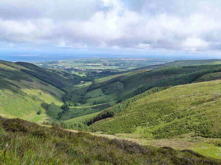
We stopped for a while on
the side of Slieau Dhoo, to rest and enjoy the view down Glen Dhoo to Ballaugh
and the northern plain. Lying on a comfortably springy clump of bilberries,
enjoying the warm sunshine, perfect peace and lovely view, I thought "Life can't
get much better than this!"
I took a number of photos of
the little valley below us (on the east side of Glen Dhoo), hoping to be able to
locate some hut circles, mounds or sheilings which are supposed to exist in that
area. When we got home, I checked all three of my large scale maps and found
that they not only disagreed on the terminology but also showed the "hut
circles, sheilings or mounds" in varying numbers and different positions. It is
very confusing. I think the Ordnance Survey map may be the most reliable but we
will have to go back to have another look.
Rather than follow the sheep
path down a steep and slippery route alongside the little tributary below us, we
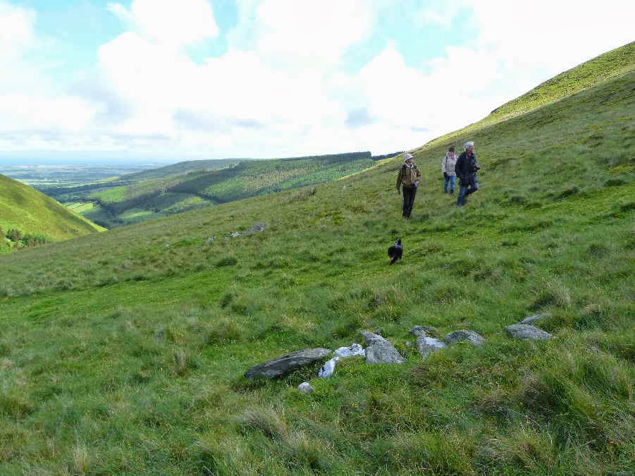
continued to circle the hill until we reached another mystery. There are three
short lines of stones on the lower slopes of the western side of the hill. They
are too far apart to be part of a building and too short to be unfinished
walls. The stones in all three rows are laid in the same direction, down the
slope, and the centre row is slightly lower down the hill than the others.
There is nothing on any of the maps to indicate their purpose. There are no
other stones on the hillside so they must have been brought here for some
special purpose.
Once we reached the upper
reaches of the Ballaugh River, we walked down a convenient sheep path along the
top of the steep bank above the stream.

As we turned the corner of
the wall around the plantation, we came across this unusual growth on the
stones. I am not sure what it is - but it may be a type of
lichen.

Further down, where the glen
widens out, there are fields, a couple of ruined farmhouses and this old mill on
the bank of the stream. Dorothy says she has a book on Glen Dhoo and that it
says there was a thriving and industrious community here in the
past.

Not far from the mill we
noticed this old bit of machinery possibly a gear from the water mill, lying in
the grass by the path . . .

. . . with a wild orchid
sheltering behind it.

As we crossed the slate
bridge over the stream by the old farmhouse, we met a woman who was compiling a
list of plants in the nature reserve. She had plenty of wild flowers to add to
her list. As we walked along the lane back to the cars we passed masses of
summer wild flowers, including foxgloves, buttercups, germander speedwell, white
burnet roses, pink roses, honeysuckle and this bright patch of red campion. I
am not sure why it is still called "red" campion when it is pink but I read
somewhere that the word "pink" is derived from the flowers called pinks
and has only been used to describe the colour since the seventeenth century. So
I suppose before that the whole range of colour from pale pink to bright red was
referred to as red.

No comments:
Post a Comment