No fireworks . . . but some weird
weather!
Monday 5th November,
2012
We started early because it is a fairly long
drive (by Isle of Man standards, anyway) from Glen Auldyn, which is in the north
of the Island, to Crosby which is almost dead centre. It was slightly frosty
when we left home after a clear night. As we drove down the glen, the car
"pinged" at us to let us know that it was feeling cold after leaving its
warm(ish) garage. The temperature reading had dropped to 4 degrees. We were
puzzled by this 4 degree ping when we first got the car but decided that it must
be warning us that it was down to a temperature where there was a possibility
of residual ice patches on the roads. When we got to Glen Helen it was even
colder - down to 1 degree and the fields alongside the river were white with
frost.
We met the others near the Crosby cricket
ground and set out along the old railway line. We had decided to do a walk that
was based on a route described in a little booklet "Holiday Walks in the Isle of
Man". It would take us up to Archallagan Plantation and then back along a farm
track and down Old Church Road. Not a very long walk. The book said that it
was seven miles but we didn't follow the route exactly because we took a
different path through the plantation.
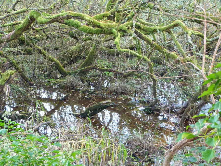
This stretch of the old railway line runs
through the central valley between Peel and Douglas. It was muddy in places but
is reasonably well hardened. There is a ditch on one side and a swamp on the
other and in places we were only a few inches above water level. Not a lot to
see . . . so you will have to put up with the obligatory swampy pool and mossy
willow photo.
We walked along this path for about two
miles, looking for a path on the left which was supposed to lead up through a
farmyard to the old mine workings at the edge of the plantation. Trevor was
keen to turn up a concreted driveway which looked too much like the entrance to
an expensive house for my liking. After dithering a bit we decided to continue
along the railway line and, after some semi-rational thought, I realised that it
couldn't be the right turning because the plantation behind the house was too
close to the railway line. And plantations or woods don't move unless they are
part of the plot in a Shakespearean drama. Further on we came to a much more
promising rough track through a property which looked and smelled like a real
farm and had a footpath sign at the junction.
We climbed up a steep track between high
hedges until we emerged in the sunshine at the top of the hill. We planned to
take photos of the old Cornelly Mine buildings. The chimney is visible at
the left of this photo of Tim's . . .

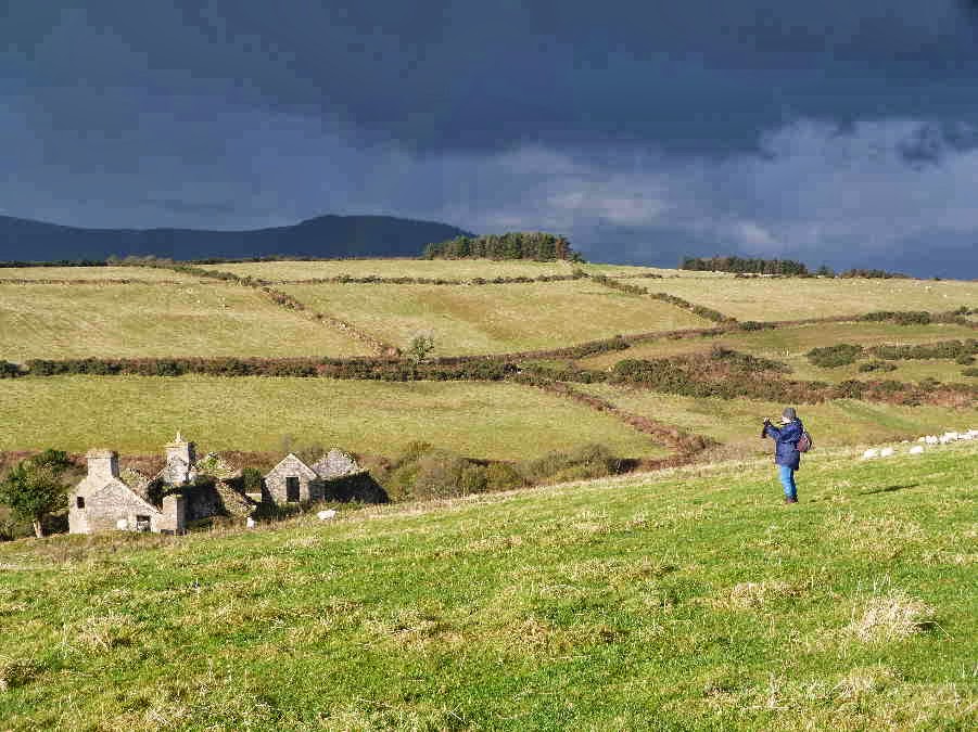
. . . but Dorothy (and Trevor) got distracted
by these ruins. I didn't walk down to have a close look because I don't like to
trespass in fields of sheep when I have a dog with me. So I am not sure whether
they are farm buildings or the remains of old cottages built for the
miners.
Although the sun was shining there were
ominous clouds on the horizon. The ones you can see in the photos (to the
west) didn't appear to be getting any closer but there were others creeping up
behind us, unnoticed, and a few drops of rain started falling as we eventually
walked on towards the mine. I wondered whether we would find any shelter at the
mine buildings. Then the heavens opened as we climbed over a stile near a
house. But the age of miracles hadn't passed. Just beyond the stile was a
rough carport and we stopped to shelter from the rain, which got even harder and
then turned to hail. The individual hailstones weren't large but there were
plenty of them and we were extremely grateful to be under shelter . . . even if
the roof was a bit leaky. The only member of the party who would have preferred
to continue with the walk was Danny, who is a fanatical walker. When the hail
finally stopped we decided to forget about the mine photos, in case there was
another shower, and to head straight into the nearby plantation where we would
be sheltered by the trees.
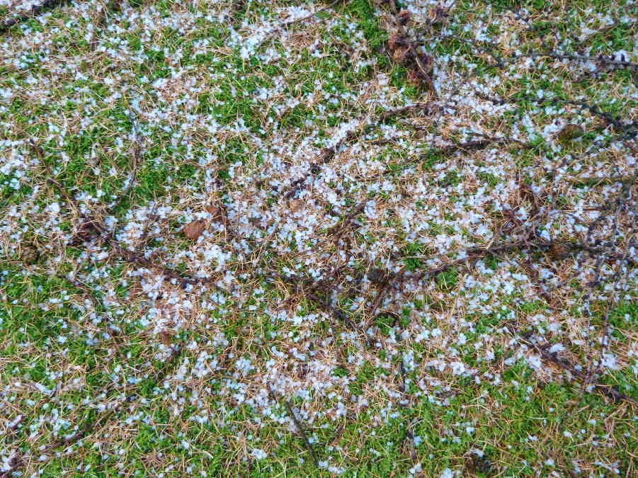
I took this photo of some hailstones on the
moss under the conifers.
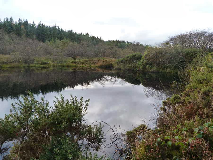
The reason for our deviation from the holiday
walk was that we wanted to visit a pool in Archallagan. According to Stan
Basnett, it is a man made pool and is the source of the River Dhoo which flows
east to Douglas. The Dhoo is said to give Douglas half its name - the other
half being provided by the River Glass. The Ordnance Survey map appears to
show another stream from the other side of the pool which becomes a tributary of
the river Neb and flows to the west coast at Peel. The pool doesn't seem to
have an official name. Stan Basnett, who describes it in his book "Hidden
Places of Mann" just calls it the hidden pool. A good name because it isn't
easy to find. We had been there before - a few years ago - but the path that we
used last time looked very muddy and overgrown with gorse . . . almost
impenetrable. So we made our way through the conifers, hoping for the best.
Just when we thought we were lost, we caught a glimpse of water through the
trees and suddenly we were there. Our first view of the pool.
We walked around the edge of the pond and
took photos from all angles. The clouds were retreating, sun was starting to
shine, and there was even a little blue sky reflected in the water.

We found our way out of the plantation
without any problems and walked along a puddley road through farmland. Tim took
this photo across the central valley, showing the King's Plantation (or Greeba
Plantation) with Greeba and Slieau Ruy behind.

The next bit of excitement was finding the
road ahead completely blocked by hurdles and a large flock of sheep being herded
in an adjacent field. It sounds a bit sexist to call this woman "the farmer's
wife" so maybe "female farmer" is better. Anyway she asked us to wait . . . so
we stayed well clear of the action in case we scared the sheep . . . and watched
proceedings.

The female farmer, who was on foot, was assisted
by a male farmer on a quad bike and a sheepdog (also on foot). And they managed
to get the whole flock penned on the road.

Then they moved the hurdles on the right side
away from the wall so that we could get past. I asked whether they were moving
the sheep further up the road but apparently they were just working on the road
because the field was too wet. I expect they were inoculating the sheep or just
checking them.
There was an interesting arrangement of
stones in a field further down the hill. It isn't mentioned on the maps or in
any of my books and doesn't appear to have any significance . . . but it looks
as though it should!

Our final photo stop was at Marown Old Church
but I have so many photos already that I think I had better send the church
photos in another email!
No comments:
Post a Comment