Wednesday, 14 November 2012

Ballaglass

 
PS Yet more wet leaves.
 
Wednesday 14th November, 2012

I must apologise for the surfeit of photos.  But, considering the number that I took, you are lucky that I didn't send even more!  I decided to split the photos into two batches to keep the main email under 2MB.


Soon after leaving the car park we saw this little beech tree.  Made me think of Kipling - If you can keep your leaves when all about you  are losing theirs . . . 


A view from the road down to Port Cornaa.  A variety of trees in the valley behind a row of ivy covered ashes.


On the Barony path we passed this popular picnic site by the river.  Very tough (or maybe very stupid) people have been known to swim in the pool below the little waterfall.


And after our coffee break we passed this peaceful scene . . . a field of loaghtan sheep . . . with North Barrule in the background.


Our faithful companion, Danny.  I wasted a lot of time trying to get a good photo of him.  Tim took one and it was better than any of mine.  I think Danny may have been watching me while I was photographing some yellow stagshorn fungus which was growing on the old stump.


Monday, 5 November 2012

Archallagan

No fireworks . . . but some weird weather!
 
Monday 5th November, 2012
 
    We started early because it is a fairly long drive (by Isle of Man standards, anyway) from Glen Auldyn, which is in the north of the Island, to Crosby which is almost dead centre.  It was slightly frosty when we left home after a clear night.   As we drove down the glen, the car "pinged" at us to let us know that it was feeling cold after leaving its warm(ish) garage.  The temperature reading had dropped to 4 degrees.  We were puzzled by this 4 degree ping when we first got the car but decided that it must be warning us that it was down to a temperature where there was a possibility of residual ice patches on the roads.  When we got to Glen Helen it was even colder - down to 1 degree and the fields alongside the river were white with frost.
 
    We met the others near the Crosby cricket ground and set out along the old railway line.  We had decided to do a walk that was based on a route described in a little booklet "Holiday Walks in the Isle of Man".  It would take us up to Archallagan Plantation and then back along a farm track and down Old Church Road.  Not a very long walk.  The book said that it was seven miles but we didn't follow the route exactly because we took a different path through the plantation. 
 

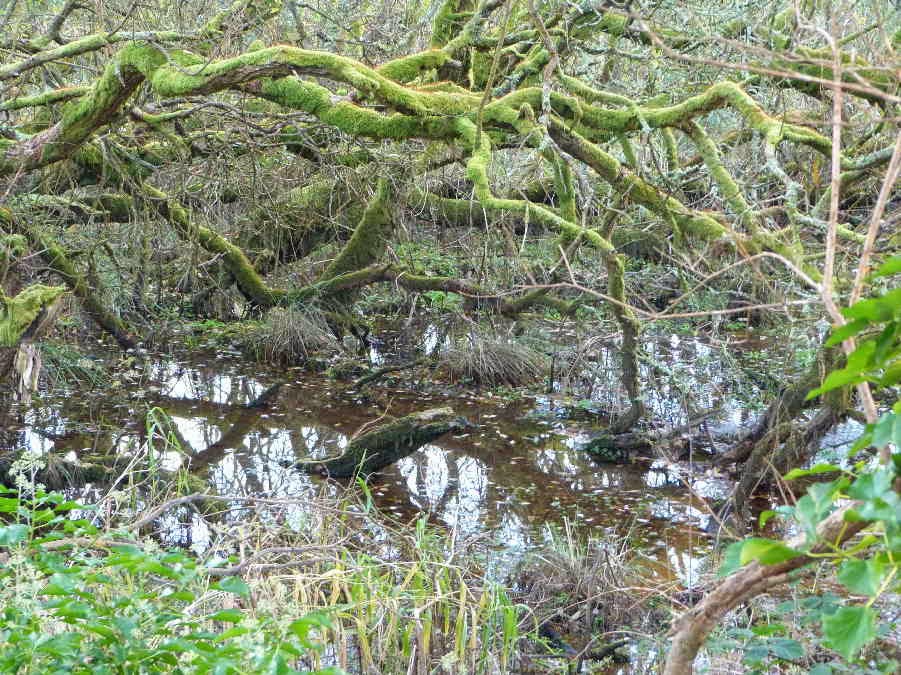
    This stretch of the old railway line runs through the central valley between Peel and Douglas.  It was muddy in places but is reasonably well hardened.  There is a ditch on one side and a swamp on the other and in places we were only a few inches above water level.  Not a lot to see . . . so you will have to put up with the obligatory swampy pool and mossy willow photo.


    We walked along this path for about two miles, looking for a path on the left which was supposed to lead up through a farmyard to the old mine workings at the edge of the plantation.  Trevor was keen to turn up a concreted driveway which looked too much like the entrance to an expensive house for my liking.  After dithering a bit we decided to continue along the railway line and, after some semi-rational thought, I realised that it couldn't be the right turning because the plantation behind the house was too close to the railway line.  And plantations or woods don't move unless they are part of the plot in a Shakespearean drama.   Further on we came to a much more promising rough track through a property which looked and smelled like a real farm and had a footpath sign at the junction.
 
    We climbed up a steep track between high hedges until we emerged in the sunshine at the top of the hill.  We planned to take photos of the old Cornelly Mine buildings.  The chimney is visible at the left of this photo of Tim's . . .


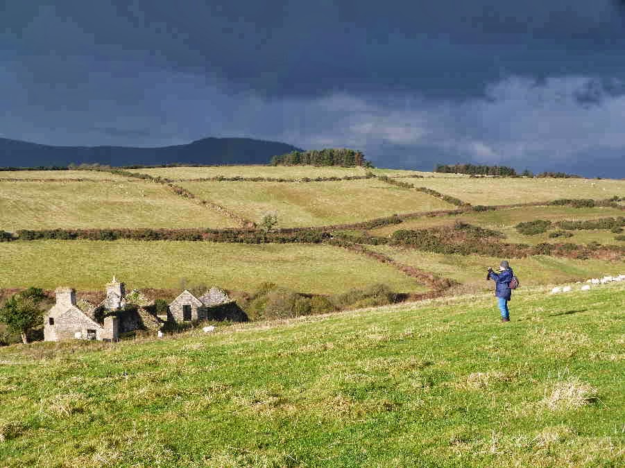
 . . . but Dorothy (and Trevor) got distracted by these ruins.  I didn't walk down to have a close look because I don't like to trespass in fields of sheep when I have a dog with me.  So I am not sure whether they are farm buildings or the remains of old cottages built for the miners.


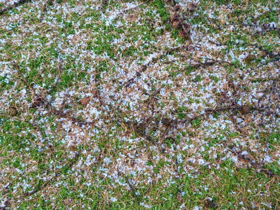
    Although the sun was shining there were ominous clouds on the horizon.  The ones you can see in the photos (to the west) didn't appear to be getting any closer but there were others creeping up behind us, unnoticed, and a few drops of rain started falling as we eventually walked on towards the mine.  I wondered whether we would find any shelter at the mine buildings.  Then the heavens opened as we climbed over a stile near a house.  But the age of miracles hadn't passed.  Just beyond the stile was a rough carport and we stopped to shelter from the rain, which got even harder and then turned to hail.  The individual hailstones weren't large but there were plenty of them and we were extremely grateful to be under shelter . . . even if the roof was a bit leaky.  The only member of the party who would have preferred to continue with the walk was Danny, who is a fanatical walker.  When the hail finally stopped we decided to forget about the mine photos, in case there was another shower, and to head straight into the nearby plantation where we would be sheltered by the trees.
 
    I took this photo of some hailstones on the moss under the conifers.


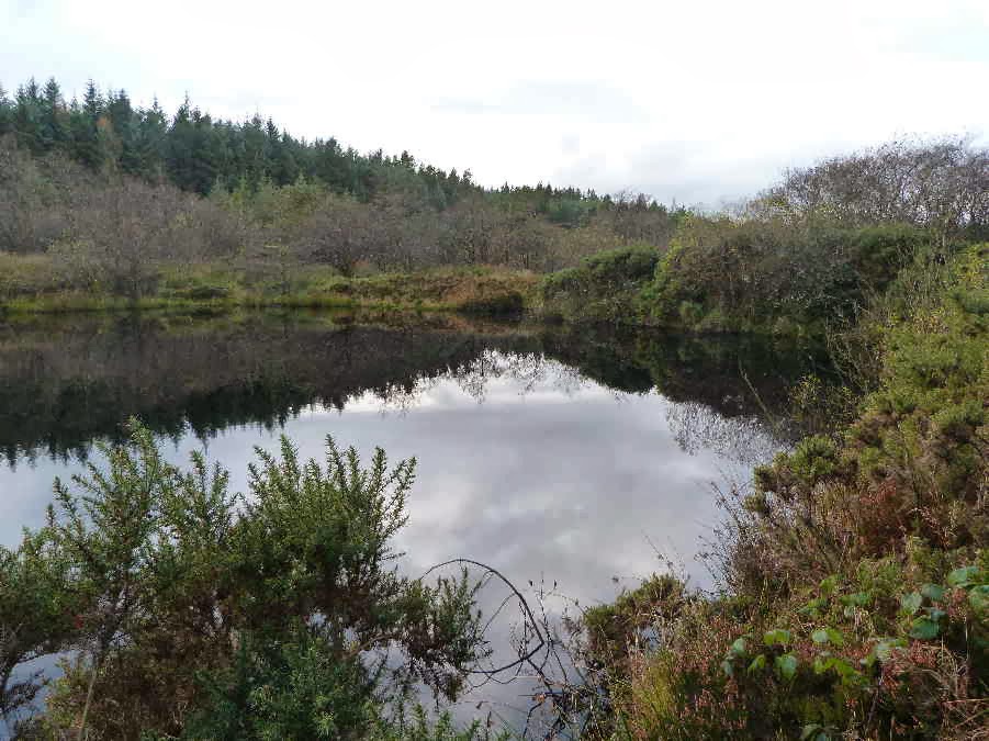
    The reason for our deviation from the holiday walk was that we wanted to visit a pool in Archallagan.  According to Stan Basnett, it is a man made pool and is the source of the River Dhoo which flows east to Douglas.  The Dhoo is said to give Douglas half its name - the other half being provided by the River Glass.  The Ordnance Survey map appears to show another stream from the other side of the pool which becomes a tributary of the river Neb and flows to the west coast at Peel.  The pool doesn't seem to have an official name.  Stan Basnett, who describes it in his book "Hidden Places of Mann" just calls it the hidden pool.  A good name because it isn't easy to find.  We had been there before - a few years ago - but the path that we used last time looked very muddy and overgrown with gorse . . . almost impenetrable.  So we made our way through the conifers, hoping for the best.  Just when we thought we were lost, we caught a glimpse of water through the trees and suddenly we were there.  Our first view of the pool.


    We walked around the edge of the pond and took photos from all angles.  The clouds were retreating, sun was starting to shine, and there was even a little blue sky reflected in the water.


    We found our way out of the plantation without any problems and walked along a puddley road through farmland.  Tim took this photo across the central valley, showing the King's Plantation (or Greeba Plantation) with Greeba and Slieau Ruy behind.


    The next bit of excitement was finding the road ahead completely blocked by hurdles and a large flock of sheep being herded in an adjacent field.  It sounds a bit sexist to call this woman "the farmer's wife" so maybe "female farmer" is better.  Anyway she asked us to wait . . . so we stayed well clear of the action in case we scared the sheep . . . and watched proceedings. 


The female farmer, who was on foot, was assisted by a male farmer on a quad bike and a sheepdog (also on foot).  And they managed to get the whole flock penned on the road.  


    Then they moved the hurdles on the right side away from the wall so that we could get past.  I asked whether they were moving the sheep further up the road but apparently they were just working on the road because the field was too wet.  I expect they were inoculating the sheep or just checking them. 
 
    There was an interesting arrangement of stones in a field further down the hill.  It isn't mentioned on the maps or in any of my books and doesn't appear to have any significance . . . but it looks as though it should!


    Our final photo stop was at Marown Old Church but I have so many photos already that I think I had better send the church photos in another email!

Marown

Part 2 - Marown Old Church
 

Monday 5th November 2012
 
As we approached the gates to the churchyard we came across this notice:


The grass around the church had just been mowed and it all looked a lot tidier than it was last time we visited - a few years ago.  Then it was high summer and only the path from the gate to the church door had been mowed.  The rest of the churchyard was knee high grass.  Tim took this photo which shows the view of the church from the gate.  This old St Runius church was replaced in about 1860 by a new parish church down by the main Douglas to Peel Road.   After that the old church was used as a  a mortuary chapel.  Part of the east end was demolished around that time and a door constructed in the east side.  You can see the position of the door in this end of the building. The east door was probably filled in when the church was restored by volunteer labour a hundred years later.  It reopened on August 9th 1959.


I did a bit of internet research on the history of the church and found this sketch which dates from 1834.


When this sketch was drawn, the church had already been enlarged.  "The church was extended westwards by about 5m in 1750-55; a record of 1798 states that the much earlier, moulded jamb-stones were removed from St. Trinian's (a ruined church down in the valley).   "About the same time a western gallery was added (the stone steps are still visible) to house musicians (violins and flutes). Like the doorway below the entrance to the gallery is flanked by massive masonry derived from an earlier site." http://www.isle-of-man.com/manxnotebook/parishes/mn/marown.htm#old

The sketch shows six windows on the south side and the existing church has four windows.  So it seems as though about one third of the church was demolished in the 1860's.  There is an account of the history of the church, written in the 1924 at this site http://www.isle-of-man.com/manxnotebook/wma/v1p131.htm
 
This photo shows the "new" part of the church on the west side.  The steps up to the original gallery are on either side of the doors below the bell tower.


There was a notice taped to the doors which read:  PLEASE CLOSE THE DOORS TO STOP THE PIGEONS ENTERING THE CHURCH   Made me think how lucky we are to live in a place where doors can be left unlocked and the only vandals around are the feathered variety.
 
The interior of the church is plain but with a peaceful, uncluttered atmosphere.


Near the altar table were some old Celtic crosses.


This photo of the windows gives an idea of the thickness of the walls.


And in the north west corner we saw these quaint old fonts.  They must be the ones described in this account of an excursion to the church in 1892.   "Outside the porch lay an old Font, of sandstone; it measured 2ft. 8in. across, and 1ft. 4in. high-the basin, which hard no outlet, being 2ft. across and 8½in deep. The outside was shaped into fourteen panels, formed by as many plain, perpendicular, narrow mouldings. Alongside the Font was a curious granite block, roughly triangular, the side measuring about 18in., hollowed out in a rough basin 9in. deep, this also was supposed to have been an ancient Font."  ( http://www.isle-of-man.com/manxnotebook/iomnhas/lm2p002.htm ) They must have been brought into the church when it was restored.


As usual, I only read up about the church after the visit.  This makes the research more interesting but always leaves me wanting to return to take more photos and look at the things which I missed on the first visit.

Saturday, 3 November 2012

Skyhill

A walk in the woods
Saturday 3rd November 2012
 
    Not quite Bill Bryson and the Appalachian Trail - just a stroll with Tim and Leo on Skyhill on a lovely autumn morning. 
 
    I have been meaning to go up with a camera ever since the work on the service reservoir was finished because I wanted to photograph the completed project.
 

    We started off from the gate at the top of our garden and I stopped to photograph some fragile little toadstools growing on an old log.  They looked prettier (and a bit less mashed) a few seconds before I took the photo.  Leo was impatient about the holdup in his walk and stuck his big, clumsy nose in for a sniff while I was getting my camera ready.


Higher up in the plantation, under the pines, there were some perfect, shiny little toadstools.


The service reservoir across the glen - photographed from the edge of the plantation above Ballagarrow Farm.


I like this photo which Tim took of Ramsey in the morning sunshine.


We stopped to look at an old Scots pine at the edge of the plantation.  It was obviously much older than the other conifers and must have been there before the plantation was created.  Tim told me about the old pines in Scotland, remnants of the Caledonian forest, and mentioned that the oldest trees are sometimes called "Grannies".  I took this photo of the bark on our Skyhill Granny.


Then we walked along a very muddy mountain bike track near the Skyhill Farm boundary.  The sun was shining through the remaining needles on the larches


And at the top of the main track we stopped to take a few photos of upper Glen Auldyn.


Monday, 29 October 2012

Beary

Not a bad walk, but . . .

Monday 29th October 2012
 
    I spent most of last weekend worrying about weather.  After reading the various weather forecasts over the weekend for Monday, and watching the rain pouring down all day on Sunday, I wondered whether we might have been a bit overambitious in planning a long hike from Tynwald Mills.  The early forecast on Monday was still a bit iffy, predicting scattered showers and sunny spells in the morning, clearing in the afternoon.  When we left home at twenty past eight (after a very welcome extra hour in bed because of putting the clocks back) the weather didn't look too bad but I still thought an abbreviated walk might be a good idea - in case the threatened showers were heavy or prolonged. 
 

    We met Dorothy and Trevor in the car park and set out up the road past the shops and then climbed up the rocky track on the west side of Beary Mountain towards an area known as the Dowse - the name of an old farm on the slopes of Beary which has all but disappeared.    The first part of the steep, stony track follows the boundary of Ballig Plantation.  We stopped for a short rest and I took a photo of this larch.  I remember being taught about deciduous and evergreen trees at primary school and being told that conifers are evergreen.   It was only when we moved to the Island that I found out that there is an exception . . . larches turn gold in autumn before losing their needles.


Further up the path we could see the damage done by the recent heavy rain.  Tim took this photo which shows why we spent most of the walk looking down at the ground, to avoid tripping over stones or stepping in holes or puddles, instead of admiring the views.


But there were some lovely scenes to enjoy when we stopped for a minute or two to get our breath back.  I liked this lonely little cloud (or wisp of mist) floating over St John's with Slieau Whallian in the background.  It was a slight consolation for missing a photo opportunity on the drive down to Tynwald.  As we drove along Lezayre Road there was a thin band of early morning mist hovering just above the ground over the fields and under the old trees at Ballakillingan.  It looked very atmospheric but sadly it isn't a good idea to stop a car on a busy road to take photos.


When we reached the point where our path met the top of Mill Road, which leads down to the main Peel to Douglas road near Greeba Bridge, we stopped to discuss our options.  I suggested walking down Mill Road and then walking along the old railway lines and Brack a Broom Lane but Dorothy looked reluctant to give up the idea of a longer walk.  Trevor tossed a coin and the shorter route won - but Dorothy looked so disappointed that we ignored the verdict of the coin and headed uphill en route to Rhenass and the Little London Road. 
 
It was very quiet up on the hill.  The only sound was the babbling of the water running down little channels that had been eroded near the path.  We headed down a track through forestry land into the dip between Beary Mountain, Slieau Ruy, Cronk y Voddy and Sartfell and then turned down a footpath towards Ballasayle.  The going was very wet underfoot and I was worried about the route through the farm which is usually churned up by cattle.  Fortunately It wasn't much worse than it is in dry weather . . . but it wasn't much fun picking our way down the rough path at the top of a bank - the official "footpath" resembles an overgrown swamp, blocked with gorse and rushes.
 
When we approached the old ruined farm buildings at  Ballasayle, the track improved and we came across a field of Highland cattle.


I think a group of mad, puddle-dodging hikers was the most interesting thing to pass their field all day.  A few drops of rain started falling and my camera was safely packed in a plastic bag. Tim took this photo of the inquisitive beasts.


Having made our way through the farm, the next obstacle was the ford at the Rhenass River.  The stepping stones were almost under water but fortunately a kind man, who was building an extension on the nearby farmhouse, said that we could walk through the building site and cross their bridge.


After crossing the river, most of the route back to the cars was along minor tarred roads, but we still had one steep climb from the Rhenass valley up to the Little London Road.  I stopped for a rest and took another photo of Ballasayle from a different angle, with the forestry track down the lower slopes of Beary Mountain visible in the background on the right.


As we reached the Little London Road, the view changed and we could look north towards the outline of the mountains in the Scottish borders.  The zoom effect makes them look even closer and more impressive.


Regarding the rest of the walk (down the Little London Road to cross the main road at Cronk y Voddy and then along the Staarvey Road) . . . the less said the better.  We were tired after hours of rough walking and the rain which had avoided us for most of the morning arrived.  Also we were walking along tarred roads and Alexander had to be on the lead in case of speeding cars.  Now Alexander doesn't like walking on the lead and he doesn't like the rain.  So he wasn't a happy chappie.  At one point he looked so miserable that Tim picked him up and carried him for a bit.  But he cheered up when the rain stopped we let him run free for a while as we walked down the track towards the Poortown Road.


Nearly back . . .  and St John's looked very pretty in its autumn setting.
 

So, all in all, not a bad walk . . . but it would have been even better if it had been a bit shorter and a bit drier!
 
PS  Poor little Alexander was very tired on Monday evening.  He lay on a mat in the kitchen and only had enough energy to open one eye when I spoke to him.  We wondered whether we were expecting too much of him.  Four hours of rough walking, without even stopping for a tea break because it was too wet, is tough on a small, plump, elderly dog.  Happily, the next morning he was fine - full of bounce and trying to boss his bigger brothers again.