Tuesday, 27 November 2012

Staarvey Road

A muddy walk with ruins.
 
Tuesday 27th November 2012
 
A few photos from our last walk.  Dorothy likes this walk because of the ruins!
 
The first ruin  was just past a field of cows - one of which Trevor said might be a bull.  So Dorothy and I waded through thick mud behind a hawthorn hedge at the far edge of the field until we reached the remains of the old farmhouse. 
 

Tim took this photo while I was trying to get a close-up of the little alcove in the slate wall which looked like a very small built-in cupboard!  The remains of the horse mill are in the foreground.


The second ruin behind a "Manx hedge" (sod bank and hawthorns).


View across a field of turnips to Peel.


A muddy walk along the railway line.


Some gulls enjoying their own private pool in one of the fields alongside the railway line.  At least someone was benefitting from all the wet weather.


Tim noticed these cows huddled around their hay in a field alongside Brack-a-Broom Lane.  Lower slopes of Slieau Whallian in the background and some impressive mud in the foreground.


Wednesday, 21 November 2012

Slieau Dhoo

Still walking . . . with Alex this week.

Wednesday 21st November, 2012
 
    We walked this morning in "changeable" weather.  The forecasters had promised a dry day after two days of heavy rain and gale force winds.  They were wrong again.  It started raining as we left the house and we drove through a heavy shower, which stopped before we reached Ginger Hall, and then another shower which started as we approached the parking area at Tholt-y-Will.  We waited in the car for a few minutes until the worst of the shower had passed by and then set off up the road towards the dam. 
 
    I didn't want to risk getting my camera wet - so I left it in the car and nearly all the photos were taken by Tim this week.  I may not be sending photos every week for a while - it depends on the weather and the light which are not always great for photography at this time of year.
 
    We turned up through the plantation just after passing the old school house and followed the steep zig-zag track through the trees up to the old ruined farm, Sherragh Vane.  The wind was much lighter than predicted, and the rain seemed to be holding off, so we decided to head out of the trees and up to the top of Slieau Dhoo.
 

    As we climbed the hill, we could see a patch of sunshine across the sea on the Mull of Galloway, and another small patch lighting up part of the northern plain of the Island.  I said to the others that the little white church of Jurby looked so pretty in the sunlight and all we needed was a rainbow to complete the picture.


I almost got my wish.  A few minutes later there were a few drops of rain and a rainbow appeared . . . but we lost the patch of sun and the church was barely visible in the gloom.


Down the other side of Slieau Dhoo we picked our way along a sheep path - past the dub and through the heather.


Alexander has always loved puddles and he headed straight for this one in a little grassy depression on the side of the hill.  I always carry a bowl and some fresh water for the dogs but it seems pointless except in exceptionally dry weather because they prefer to drink from puddles.


We walked down the hill towards Montpelier and then returned along the Druidale road and past the Sulby Dam.  The rain clouds had gone and it turned into a lovely sunny morning.


have never seen the dam as full as this before.  It had reached maximum capacity and water was running down the overflow drain.


There was plenty of water in the series of little waterfalls down the sides of the glen, too.


This photo of the Sulby River below the dam gives an impression of the height of the dam wall behind the grassy terraced bank.


Wednesday, 14 November 2012

Ballaglass

 
Almost the full autumn experience

Wednesday 14th November, 2012
 
    Dorothy arrived back safely on Tuesday after her trip to London.  She saw "Singin' in the rain" and went to a couple of wonderful photographic exhibitions - the Ansel Adams exhibition in Greenwich, and the Wildlife Photographer of the Year exhibition at the Natural History Museum.  I sent her an email suggesting the Ballaglass/Cornaa/Ballafayle figure of eight walk for Wednesday morning and wrote "We haven't done that since spring . . . and the autumn leaves under the beeches in Ballaglass Glen may be quite pretty.  I don't expect there will be many leaves left on the trees."
 
    I was right about the leaves on both counts.  We got completely carried away and I took nearly a hundred photos during the walk.  Trevor even commented "Everyone goes to Ballaglass for the bluebells . . . but this is even better!"  So this is an email which should carry a Government Health Warning . . . If you have an allergy to wet leaves - delete before viewing!
 

    We started along the upper path from the car park towards the top end of the Glen  . . . walking over a carpet of beech and elm leaves.  The only thing missing from the "full autumn experience" was the crackle of crisp leaves underfoot.  The leaves were too wet and the best they could manage was a damp rustle.


We were heading towards a row of three of the oldest trees in the glen.  I wonder when they were planted.  I had thought that they were all horse chestnuts but now I am not so sure.  The first one we came to was definitely a chestnut but there didn't seem to be many horse chestnut leaves under the other two.  I will have to check next year when they have their new leaves.


We crossed the bridge at the top of the glen and headed up the steps towards the electric tram station.  Dorothy was lagging behind, reluctant to leave the river.


While we were waiting for her, I took a photo of the men outside the station . . . not quite Grand Central!  The gate is a fairly recent addition to keep the sheep out.  Sheep are rather good at escaping from their fields and used to shelter in the building.  I don't think the tourists appreciated having to wait for their trams in a litter of sheep droppings.


We walked along a muddy footpath outside the stone wall above the glen.  Tim was muttering about the mud.  I think he felt slightly cheated.  I had taken Danny instead of Alexander because I said that there would be a lot of road walking . . . and we hadn't walked along a single road so far.  The poor man didn't get much sympathy.  I just said "Whoever complains most during a walk has to plan the next one!" 
 
Happily, the next section was on tarred roads.  First up the hill past Cashtal yn Ard, down to the ford near the end of the Glen Mona footpath and then along the road to Port Cornaa.  On the way down the hill towards the ford, I climbed up onto a bank and took a photo of Port Cornaa in the valley below.  The tide was in - but it didn't look as though the path would be under water.


When we reached the shore, we saw that the tide had come in further and it was touch and go whether we would reach the bridge with dry socks.


Tim took the last photo of me and Danny - and I took the next one of him!


After crossing the bridge, we made our way up the track through the Barony Estate.   we passed this weird beech tree.  I had always assumed that the thick limb which juts over the path was a side branch but Tim looked at it carefully and said that he thought it was the main trunk which had been damaged and had grown at an odd angle.  I think he is right.


I have photographed these beech trunks before but I can't resist them.  They look almost like legs with little "toes".


A little further on, we stopped for coffee but we didn't time it well because there was a brief shower of rain.  I wondered whether it would be a good idea to scrap the Ballafayle section of the walk if it was still raining when we reached the track back to Ballaglass.  The rain stopped before we reached the junction, but Dorothy was looking a bit tired after all her travelling and I asked whether she would prefer to return to the cars.  She admitted that she was feeling "a bit feeble".  That is the last word that I would use to describe Dorothy but we headed back to the glen, went in the lower gate and wandered up the river - taking even more photographs.  Dorothy is standing on a mysterious structure.  It looks like the support for an old bridge dating back to the pleasure garden era but there is nothing visible on the other side of the river.  Perhaps the other pier got washed away during a flood . . .  but there are no traces of a path either.


And finally, one more river photo - taken from a wooden bridge further upstream:


 There was another shower while we were putting our backpacks in the cars so it was lucky that we didn't finish the planned route.

Ballaglass

 
PS Yet more wet leaves.
 
Wednesday 14th November, 2012

I must apologise for the surfeit of photos.  But, considering the number that I took, you are lucky that I didn't send even more!  I decided to split the photos into two batches to keep the main email under 2MB.


Soon after leaving the car park we saw this little beech tree.  Made me think of Kipling - If you can keep your leaves when all about you  are losing theirs . . . 


A view from the road down to Port Cornaa.  A variety of trees in the valley behind a row of ivy covered ashes.


On the Barony path we passed this popular picnic site by the river.  Very tough (or maybe very stupid) people have been known to swim in the pool below the little waterfall.


And after our coffee break we passed this peaceful scene . . . a field of loaghtan sheep . . . with North Barrule in the background.


Our faithful companion, Danny.  I wasted a lot of time trying to get a good photo of him.  Tim took one and it was better than any of mine.  I think Danny may have been watching me while I was photographing some yellow stagshorn fungus which was growing on the old stump.


Monday, 5 November 2012

Archallagan

No fireworks . . . but some weird weather!
 
Monday 5th November, 2012
 
    We started early because it is a fairly long drive (by Isle of Man standards, anyway) from Glen Auldyn, which is in the north of the Island, to Crosby which is almost dead centre.  It was slightly frosty when we left home after a clear night.   As we drove down the glen, the car "pinged" at us to let us know that it was feeling cold after leaving its warm(ish) garage.  The temperature reading had dropped to 4 degrees.  We were puzzled by this 4 degree ping when we first got the car but decided that it must be warning us that it was down to a temperature where there was a possibility of residual ice patches on the roads.  When we got to Glen Helen it was even colder - down to 1 degree and the fields alongside the river were white with frost.
 
    We met the others near the Crosby cricket ground and set out along the old railway line.  We had decided to do a walk that was based on a route described in a little booklet "Holiday Walks in the Isle of Man".  It would take us up to Archallagan Plantation and then back along a farm track and down Old Church Road.  Not a very long walk.  The book said that it was seven miles but we didn't follow the route exactly because we took a different path through the plantation. 
 

    This stretch of the old railway line runs through the central valley between Peel and Douglas.  It was muddy in places but is reasonably well hardened.  There is a ditch on one side and a swamp on the other and in places we were only a few inches above water level.  Not a lot to see . . . so you will have to put up with the obligatory swampy pool and mossy willow photo.
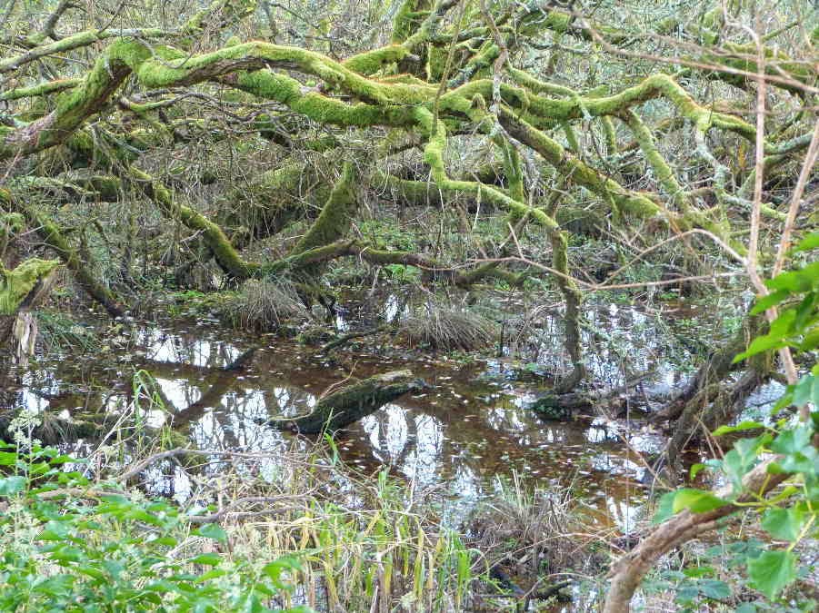


    We walked along this path for about two miles, looking for a path on the left which was supposed to lead up through a farmyard to the old mine workings at the edge of the plantation.  Trevor was keen to turn up a concreted driveway which looked too much like the entrance to an expensive house for my liking.  After dithering a bit we decided to continue along the railway line and, after some semi-rational thought, I realised that it couldn't be the right turning because the plantation behind the house was too close to the railway line.  And plantations or woods don't move unless they are part of the plot in a Shakespearean drama.   Further on we came to a much more promising rough track through a property which looked and smelled like a real farm and had a footpath sign at the junction.
 
    We climbed up a steep track between high hedges until we emerged in the sunshine at the top of the hill.  We planned to take photos of the old Cornelly Mine buildings.  The chimney is visible at the left of this photo of Tim's . . .


 . . . but Dorothy (and Trevor) got distracted by these ruins.  I didn't walk down to have a close look because I don't like to trespass in fields of sheep when I have a dog with me.  So I am not sure whether they are farm buildings or the remains of old cottages built for the miners.
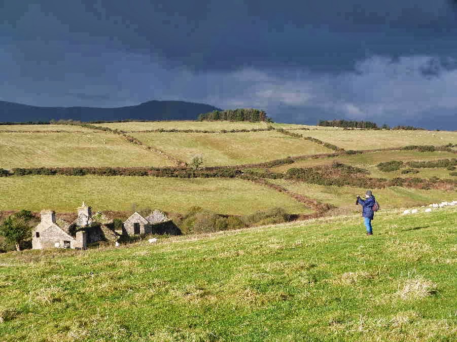


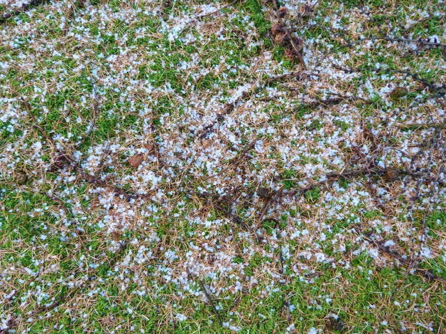
    Although the sun was shining there were ominous clouds on the horizon.  The ones you can see in the photos (to the west) didn't appear to be getting any closer but there were others creeping up behind us, unnoticed, and a few drops of rain started falling as we eventually walked on towards the mine.  I wondered whether we would find any shelter at the mine buildings.  Then the heavens opened as we climbed over a stile near a house.  But the age of miracles hadn't passed.  Just beyond the stile was a rough carport and we stopped to shelter from the rain, which got even harder and then turned to hail.  The individual hailstones weren't large but there were plenty of them and we were extremely grateful to be under shelter . . . even if the roof was a bit leaky.  The only member of the party who would have preferred to continue with the walk was Danny, who is a fanatical walker.  When the hail finally stopped we decided to forget about the mine photos, in case there was another shower, and to head straight into the nearby plantation where we would be sheltered by the trees.
 
    I took this photo of some hailstones on the moss under the conifers.


    The reason for our deviation from the holiday walk was that we wanted to visit a pool in Archallagan.  According to Stan Basnett, it is a man made pool and is the source of the River Dhoo which flows east to Douglas.  The Dhoo is said to give Douglas half its name - the other half being provided by the River Glass.  The Ordnance Survey map appears to show another stream from the other side of the pool which becomes a tributary of the river Neb and flows to the west coast at Peel.  The pool doesn't seem to have an official name.  Stan Basnett, who describes it in his book "Hidden Places of Mann" just calls it the hidden pool.  A good name because it isn't easy to find.  We had been there before - a few years ago - but the path that we used last time looked very muddy and overgrown with gorse . . . almost impenetrable.  So we made our way through the conifers, hoping for the best.  Just when we thought we were lost, we caught a glimpse of water through the trees and suddenly we were there.  Our first view of the pool.
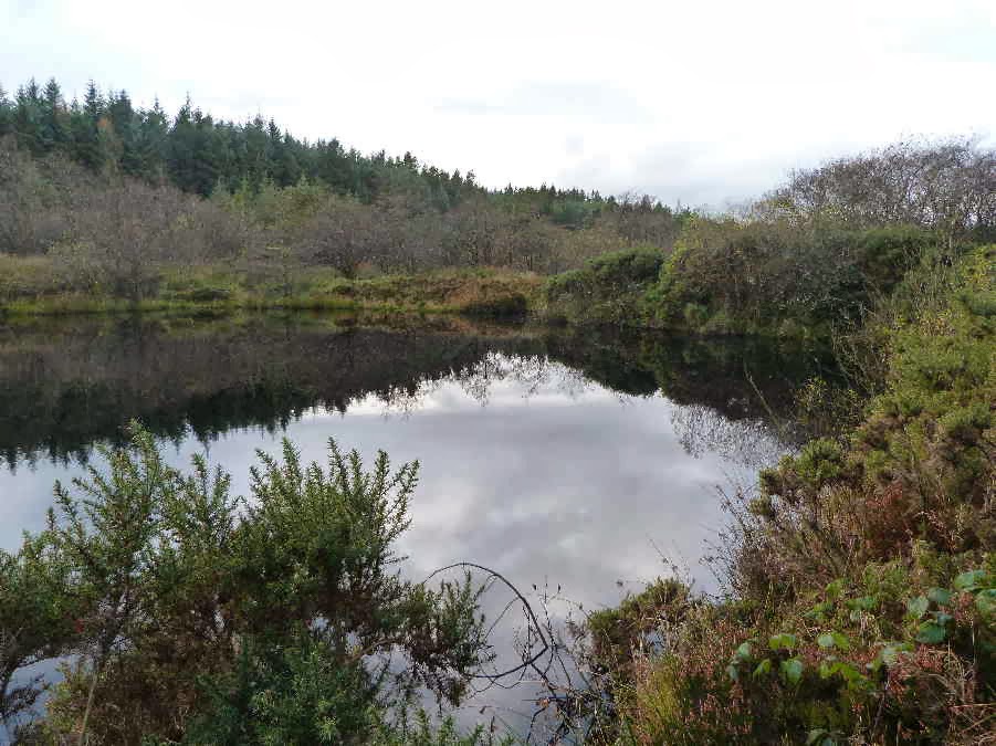


    We walked around the edge of the pond and took photos from all angles.  The clouds were retreating, sun was starting to shine, and there was even a little blue sky reflected in the water.


    We found our way out of the plantation without any problems and walked along a puddley road through farmland.  Tim took this photo across the central valley, showing the King's Plantation (or Greeba Plantation) with Greeba and Slieau Ruy behind.


    The next bit of excitement was finding the road ahead completely blocked by hurdles and a large flock of sheep being herded in an adjacent field.  It sounds a bit sexist to call this woman "the farmer's wife" so maybe "female farmer" is better.  Anyway she asked us to wait . . . so we stayed well clear of the action in case we scared the sheep . . . and watched proceedings. 


The female farmer, who was on foot, was assisted by a male farmer on a quad bike and a sheepdog (also on foot).  And they managed to get the whole flock penned on the road.  


    Then they moved the hurdles on the right side away from the wall so that we could get past.  I asked whether they were moving the sheep further up the road but apparently they were just working on the road because the field was too wet.  I expect they were inoculating the sheep or just checking them. 
 
    There was an interesting arrangement of stones in a field further down the hill.  It isn't mentioned on the maps or in any of my books and doesn't appear to have any significance . . . but it looks as though it should!


    Our final photo stop was at Marown Old Church but I have so many photos already that I think I had better send the church photos in another email!